Category Archives: ABQ Ride

Successful Transit in Albuquerque? It’s Real.

Why Albuquerque Rapid Transit is far from a “Lemon”

by Jordon McConnell

About the author: Jordon McConnell, a nonprofit healthcare and education professional with a background in humanities and French, channels his passion for French urban planning to reimagine Albuquerque’s urban form. His unique perspective emphasizes equitable and holistic community development, aiming to enhance the city’s quality of life for all.

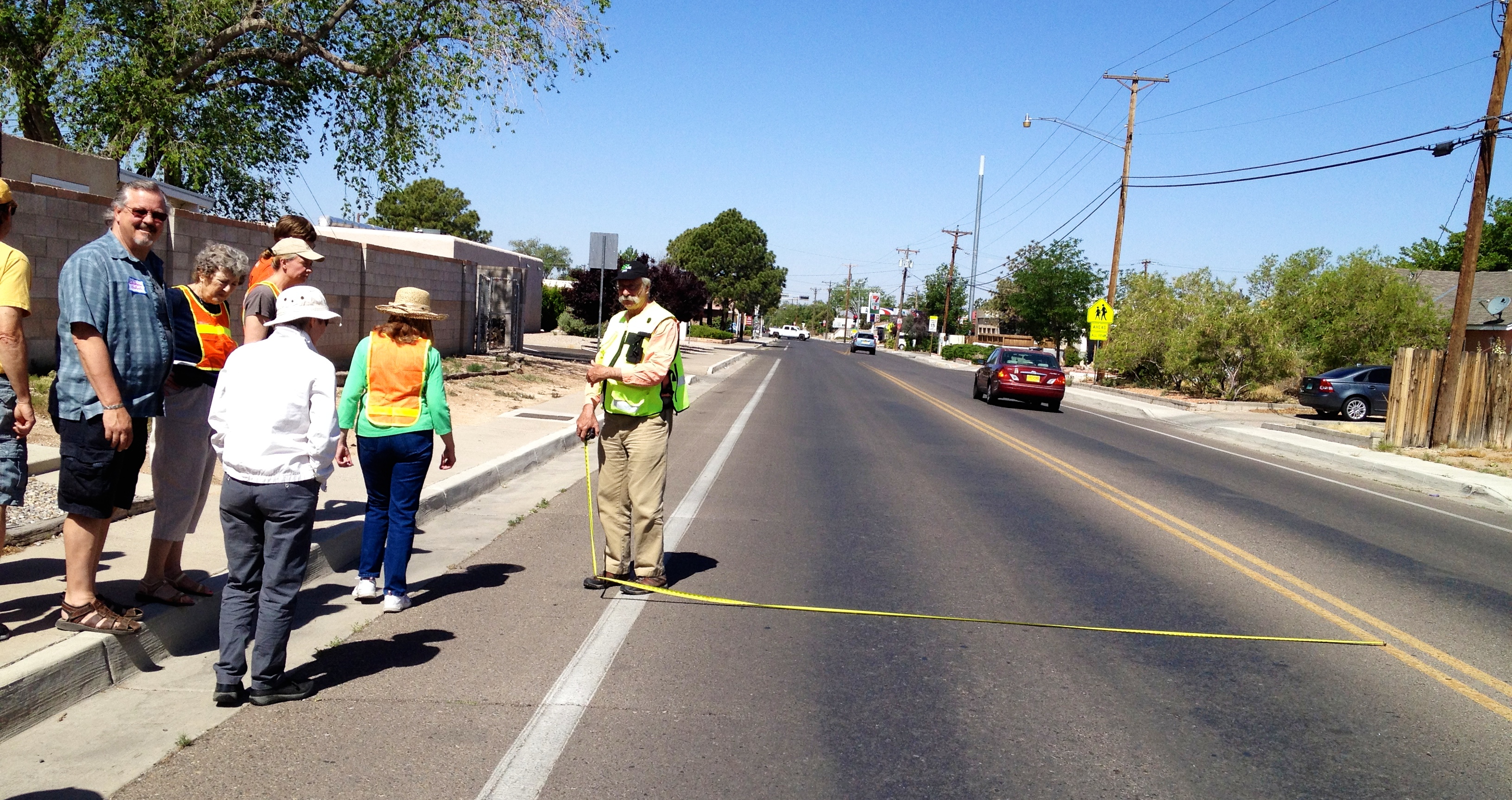
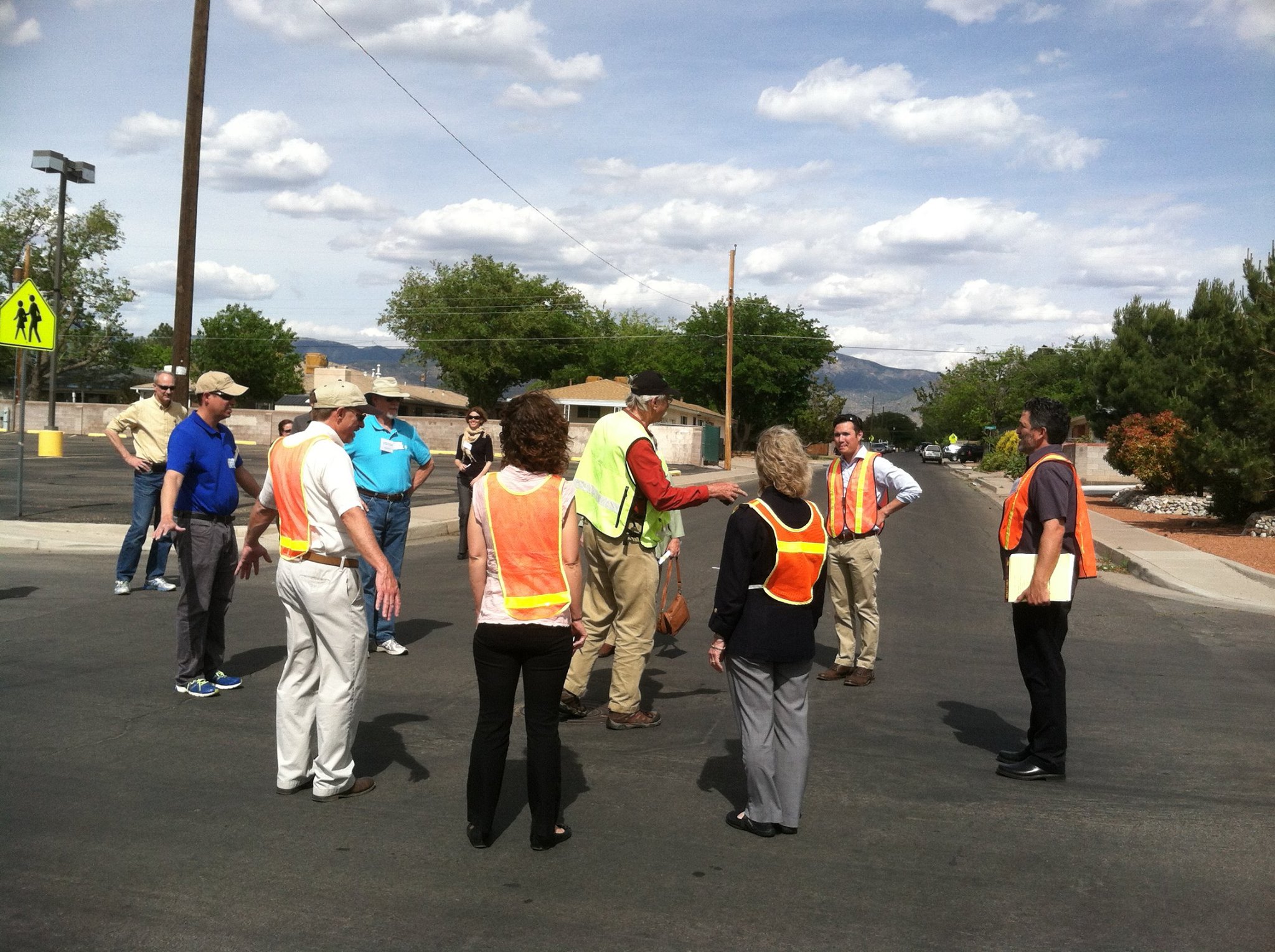
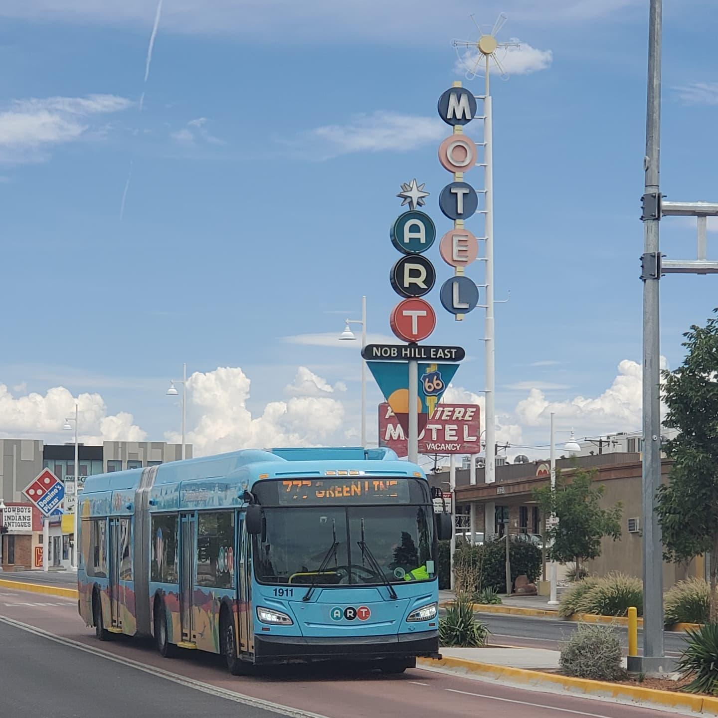
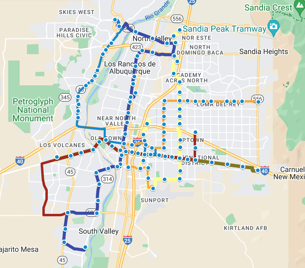
In 2011, the City of Albuquerque began studying the idea of implementing a bus rapid transit (BRT) system along Central Avenue. Bus rapid transit is a form of mass transit that can vary in look and implementation, but generally requires level-boarding platforms for buses, off-board fare payment, dedicated transitways, and signal preemption at intersections (giving buses priority for green lights). By 2016, this idea was put into action, becoming the Albuquerque Rapid Transit (ART) project. The City sought to replace the aging Rapid Ride system with a better experience, improving passenger comfort, safety, speed, and reliability on the system while also encouraging new, denser development along one of the city’s main thoroughfares. 

The project proved to be controversial and lawsuits attempted to block ART, but construction began in earnest in 2016. At the end of construction, the city had a pair of rapid transit lines running 12 and 14 miles respectively, including 11 miles of shared, dedicated transitway. The system featured enough of the attributes of a true BRT that it was awarded the first Gold-Level service standard in the United States by the Institute for Transportation and Development Policy. Controversy continued after its initial opening, as buses provided by BYD Industries proved unable to service the ART routes, causing the system to be delayed. By 2019, the City procured new replacement buses and put the system into regular operation after a two-year delay. In its first few months of service, before the COVID-19 pandemic, the ART succeeded in surpassing the old Rapid Ride’s ridership by over 30%.
Despite this, in 2018, Mayor Keller infamously stated that ART was a “bit of a lemon.” This is a sentiment still felt by many Burqueños, some of whom feel that the project was a waste of money, poorly executed, or unnecessary. Is ART, in fact, a waste? Or is it an essential and successful piece of transit infrastructure and a catalytic part of the city’s urban history?

In a solid rebuke to the project’s detractors, including the Mayor, ART is actually exceeding ridership expectations despite the after-effects of the pandemic and shows a path forward toward a more urban, more equitable, and lower-emission Albuquerque. While concerns about the project’s initial design and implementation are valid, it is important to acknowledge the game-changing nature of ART and the long-term benefits it can bring to Burqueños. 

Why Was ART Built When the Rapid Ride Was Already There? 

A common view held by detractors is that the ART project was redundant or unnecessary as the previous express bus system on Central Avenue, the Rapid Ride service, was adequate. Let’s address this first. Though the system had “Rapid” in the name, it was a misnomer, as the Rapid Ride failed to accomplish the goals of a true rapid transit system. ART, however, was designed to complement the urban fabric of the corridor while enhancing and providing a more advanced, faster, and more efficient transit option along the corridor. 

As Albuquerque continues to evolve into a medium-sized metropolis approaching a million people, investing in rapid transit is not just a matter of convenience but a strategic necessity. Rapid transit projects like ART play a pivotal role in addressing the escalating challenges posed by traffic congestion, air quality, and the demand for more sustainable transportation options. By embracing efficient and environmentally friendly transit solutions, Burqueños can ensure that our transportation infrastructure aligns with our city’s growth trajectory – fostering economic development, reducing urban sprawl, and enhancing the overall quality of life for residents. In this context, ART can do what Rapid Ride simply could not.

Here’s the context: 

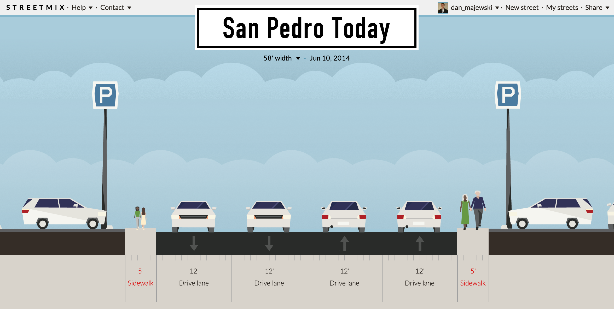
The Rapid Ride had lower frequencies than what we enjoy with ART. The best frequencies enjoyed on Rapid Ride (every 15 minutes for each line, or about every 8 minutes where they shared their route), are the minimum frequencies for ART on weekdays. For those of us who routinely used the Rapid Ride to commute, these frequencies were rarely actually the case, with buses often delayed. 

A large part of ART’s success is due to its dedicated busway, which Rapid Ride lacked. The frequency of Rapid Ride was often worsened by interactions with traffic congestion. This led to “bus bunching,” where a bus falls behind schedule while the next bus catches up to the delayed bus, leading to a situation where both buses arrive at the same stop close together or at the same time. It was not uncommon for bus bunching to cause up to 40-minute delays on Rapid Ride buses! In addition to traffic congestion, this phenomenon could be caused by passenger boarding and disembarking. At busy stops such as Alvarado Station (especially after a Rail Runner train arrived) or UNM at Central and Cornell, buses were often held up for as long as ten minutes while large numbers of passengers boarded the bus and paid their fare. 

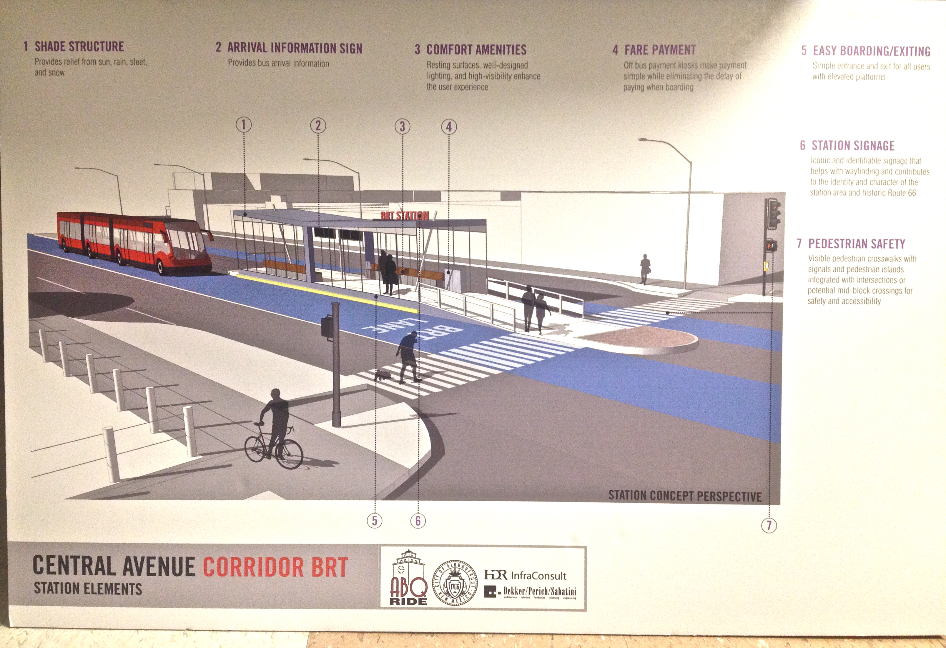
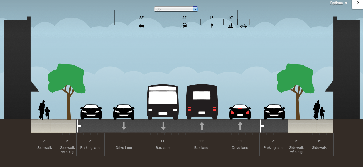
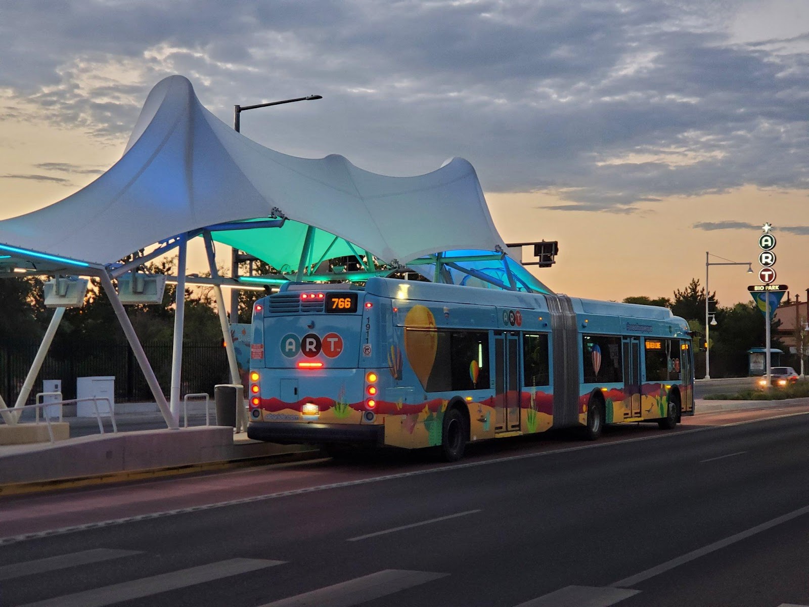
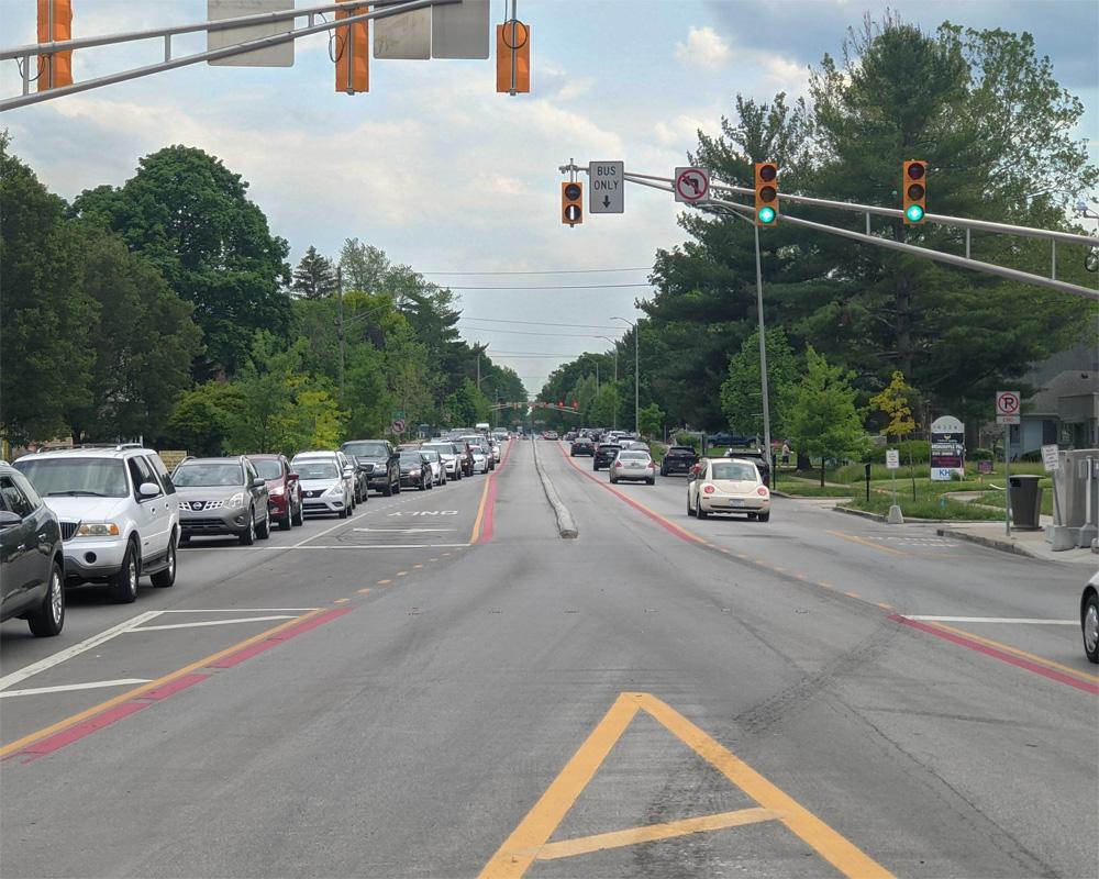
As a BRT system, ART was designed to offer even greater efficiency and quality of service compared to traditional bus systems (including the Rapid Ride), by incorporating dedicated bus lanes, modern stations, signal priority, and other features. In allowing vehicles to bypass traffic congestion as well as allowing passengers to board the bus at all doors, ART was designed to stay on schedule and deliver a better experience for passengers. In addition, the level-boarding enabled by the station platforms also allows for faster boarding for folks who use mobility aids, such as wheelchairs, as well as families with strollers, bicycles, and other wheeled devices.

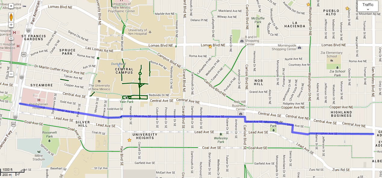
Another complaint is that the system was implemented along Central Avenue, rather than Lomas Boulevard. In short, the decision came down to a few major factors:

  • Central is the backbone of the city’s transit network and often had full buses that prohibited expansion on other routes, such as San Mateo. 
  • At the time, Central hosted the busiest bus routes in the city, so there was a need to improve travel times and service quality along this corridor. BRT along Central would impact and improve service for the highest number of riders as well as increase capacity to allow for future expansion to other corridors.
  • Central Avenue is a mixed-use corridor running through the city’s densest neighborhoods, a prime corridor for rapid transit, linking homes to job centers.
  • Rapid transit along Central Avenue provides the biggest potential for increasing housing, commerce, and investment in the city. 
  • The introduction of the ART system also aimed to encourage economic development and revitalization along the Central Avenue corridor, similar to how BRT systems have been used in other cities, such as along the Cleveland Health Line, to stimulate local economies.
  • For example, shifting rapid transit to the center lanes helps calm auto traffic while allowing transit to remain fast and efficient, and in doing so, induces people to spend more time (and dollars) at shops and restaurants in Nob Hill and EDo, resulting from a safer, quieter environment.  
  • Placing ART on Central Avenue aligned with broader City planning goals, such as promoting sustainable transportation, reducing traffic congestion, and enhancing the quality of public transit.
  • Travel demand patterns and congestion levels were factors in selecting Central Avenue as the route for ART. Placing the system where there is higher demand and traffic congestion, simply offered more benefits.

Decisions like where to make rapid transit investments are complex and involve numerous considerations. Ultimately, the choice of Central Avenue over Lomas Boulevard for the ART system resulted from a combination of factors that aimed to maximize the benefits for the city, its residents, and its transportation infrastructure.

How ART has Succeeded

Beyond its functional transportation utility, ART has also succeeded in reimagining Albuquerque’s urban landscape. Its design philosophy, focused on safer streets, efficient movement, and pedestrian-oriented streetscaping, has revitalized the aesthetics of the station areas and made Central Avenue a safer and more enjoyable corridor. The incorporation of dedicated bus lanes, sheltered station platforms, and pedestrian-friendly features enhances the overall ambiance, transforming Central Avenue into a more vibrant space that encourages people to walk and explore. Here are just a few of the ways ART has been a success. 

Connecting Albuquerque’s Urban Hubs:

Albuquerque’s cultural richness extends far beyond Downtown, flourishing along the Central Avenue corridor, crafting a vibrant and diverse cultural landscape. While Downtown remains a vital urban destination within this corridor, cultural facilities and captivating locales are scattered across the city’s expanse. The true triumph of ART lies in its remarkable ability to unite Albuquerque’s varied urban centers. As it strings together neighborhoods and cultural hubs, it sparks interactions among diverse populations, forging connections that transcend socioeconomic boundaries. This success serves as a powerful symbol of unity and shared experiences.

What sets ART apart from many other rapid transit projects in the United States is its unique role in bridging both the wealthiest and most economically challenged areas in the region. This connectivity significantly impacts residents’ access to job opportunities throughout the city. At a public meeting about the project in 2014, Tim Trujillo spoke with a resident who lived on the West Side and worked near Sandia Labs who stated that ART and the changes it brought would allow her to cut her commute time in nearly half and spend more time with her family.

With future improvements to the corridor, particularly along the eastern stretches of Central Avenue, Albuquerque is leading by example in promoting urban equity in our country. A transportation system like ART, which serves a wide cross-section of socioeconomic populations, provides a valuable tool for individuals to access enhanced education and employment opportunities, offering transformative pathways toward economic empowerment for all.

A Revolution in Transit-Oriented Development:

As mentioned previously, ART’s alignment was carefully planned to intersect with areas that showed potential for growth. This deliberate approach has spurred transit-oriented development, attracting businesses, residences, and entertainment venues that are located in close proximity to ART’s 21 platform stations. The convenient access to rapid transit is already encouraging new development along the corridor. New multi-family residential developments such as the Broadstone Nob Hill bring in dense, market-rate housing that helps relieve pressure on rent prices while providing residents with transit-adjacent lifestyles.

The City has also worked to create more affordable housing along the corridor, such as the new Hiland Plaza Apartments at Central and Jackson, which will primarily house low-income families. Future developments are already planned to break ground throughout the corridor, including a recently awarded grant to transform the Uptown Transit Center into a dense, transit-oriented neighborhood. Zoning reforms that were implemented in 2016 in anticipation of ART helped bring these projects online, and the potential for further zoning reforms along important transit corridors could help push these improvements further. Ultimately, this growth in transit-oriented development will lead to an Albuquerque with stabilized rent prices, diversity in neighborhood and housing choices, and built-in support for local retail and restaurants.

Uptown Transit Center reimagined, image by CABQ Transit Department

Lifesaving Pedestrian Improvements and Increased Foot Traffic:

Throughout the ART corridor, project design includes improved streetscaping features such as wider sidewalks, landscaping, benches, public art installations, and pedestrian-friendly crossings. These elements make the station areas more visually appealing and inviting for pedestrians. HAWK signals, which are pedestrian-activated signals that stop traffic for crossing, help prioritize the pedestrian experience and facilitate safer crossings on Central. The improvement in safety is now documented in the data, too, and dramatically at that. Nicholas Ferenchak, professor in the Department of Civil, Construction, and Environmental Engineering and leading the Center for Pedestrian and Bicyclist Safety at UNM, has studied Central Avenue and found ART to have significantly contributed to improved safety on the corridor. In the years since ART has been in service, his research has found a decline of 65% in serious and fatal injuries, mostly due to “lowered vehicle speeds and prohibiting left turns.” 

The significance of these statistics extends beyond mere numbers. ART’s impact is particularly profound when viewed through a social justice lens. The neighborhoods served by ART encompass diverse demographics, including many individuals and families who are disproportionately low-income, PoC, refugees, immigrants, and new Americans. In the realm of social justice, concerns have often arisen over rapid transit projects potentially contributing to gentrification, displacement, and inequitable access. However, ART’s remarkable safety enhancements coupled with its commitment to inclusivity challenge these critiques. It stands as a model that demonstrates how public infrastructure projects can be vehicles for positive change, fostering both safety and accessibility while promoting economic equity for all residents, regardless of their background or circumstances.

In areas like East Downtown and Nob Hill, ART has helped create a “Main Street” feel, slowing traffic, and encouraging small business and residential development. ABQ Uptown has attracted retailers with their artificial construction of Main Street-esque facilities. The redesign of Central to accommodate ART allows for neighborhoods along the corridor to compete by leveraging their authenticity as true Main Street neighborhoods. ART provides an alternative to car travel, reducing dependence on private vehicles. As people shift to transit for more of their travel, they are more likely to walk to and from transit stations (and therefore by local businesses) instead of driving, especially for short distances. When combined with the transit-oriented developments mentioned above, we have a Central Avenue primed for human-centered growth and activities. 

While ART construction did bring short-term challenges and growing pains, it’s crucial to emphasize the lasting benefits. As seen in cities like Portland, Oregon, during the MAX Light Rail construction in the 1980s, disruptive rapid transit projects initially caused local businesses to close along their routes. However, over time, these projects have been credited with revitalizing neighborhoods and promoting local businesses. Areas like the Pearl District in Portland and the Midtown Exchange in Minneapolis have become thriving urban centers with a strong focus on local businesses. These examples demonstrate that the initial disruption may well be worth it. ART’s long-term vision prioritizes pedestrian-friendly environments, convenient transit, and community vitality. As a result, these neighborhoods are more resilient and authentic, making ART’s enduring impact a compelling success story.

Elevating Sense of Place with Improved Aesthetics:

ART’s design philosophy acknowledges the importance of aesthetics, transforming the streetscape into a more inviting environment. This has created an appealing atmosphere that draws people to explore the area, whether for shopping, dining, or leisure. Decisions to move median plantings and trees to the streetside provide shade and decrease the urban heat-island effect as trees mature. Trees placed along the sides of a street live longer than those placed in the center of the street as in the previous configuration of Central Avenue. With increasingly hot weather resulting from climate change, the provision of shade and cooler urban spaces has become an essential aspect of planning for the future. New lighting was also installed to help complement the visual appeal of the surroundings and the historical nature of the street while simultaneously addressing safety concerns and ensuring that pedestrians can comfortably navigate the area during both day and night.

Finally, ART’s dedicated stations serve as landmarks and neighborhood anchors, with distinctive designs that set them apart from regular bus stops. This helps establish a clear identity for the ART system, making it easily recognizable to passengers, including visitors, and contributing to the system’s overall branding. ART stations offer amenities such as sheltered waiting areas, seating, and real-time arrival information. These features enhance the passenger experience, making the system more attractive to potential riders and encouraging higher ridership.

Through-the-Roof Ridership:

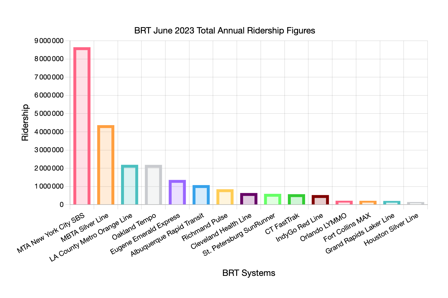
As of June 2023, ART has not only recovered but exceeded its pre-COVID ridership, hitting over a million riders between January and June of this year. This figure placed ART as the 6th busiest BRT in the United States, just behind heavy hitters like Los Angeles Metro’s Orange Line and Boston’s Silver Line.   It is actually ahead of Richmond’s Pulse Service, Indianapolis’s Red Line, and even the Cleveland Health Line, which inspired many of the United States’ BRT projects, in ridership (National Transit Database, 2023). With increased ridership continuing, it is poised to continue on this trajectory of success. With recent cuts to ABQ Ride’s regular bus system accounting for a 30% reduction in service for most local routes due to a bus driver shortage, ART’s ability to outperform the rest of the system is a testament to its utility and ability to attract riders. ART’s ridership success is also happening while downtown office vacancies remain high in the aftermath of COVID-19. Having started service only a few months before the pandemic, it is hard to avoid wondering what ridership on ART could be today had it never happened. Despite that, we can now look forward to ART cementing its place within the post-pandemic urban fabric of Albuquerque. 

While exceeding pre-COVID ridership levels is a positive sign, continued investment in maintaining and improving the system will be important to ensure its long-term success and continued positive impact on the community. Improving ridership and ART’s success will include future changes to land uses along transit corridors and constructing new ART lines to bring benefits to more of the city while also enabling more people to shift their travel to transit and away from private vehicles. 

Graph situating ART’s ridership with other BRT networks in the United States*

What Can ART Do for the Future of Albuquerque? 

It is important to view ART as a foundational step towards a more comprehensive rapid transportation network. Initial setbacks should be taken as lessons learned, and future improvements and adaptations should be made to optimize the system’s performance and efficiency. In embracing ART, Albuquerque has demonstrated a commitment to sustainability and environmental responsibility. By promoting the use of public transportation, the City is making strides toward reducing carbon emissions and minimizing the environmental impact of individual commuting choices. In prioritizing transit-oriented development along the Central Corridor, ART also works to decrease housing market pressures and create more choices for Albuquerque residents by providing diverse neighborhoods to live in. This is a success that resonates far beyond the confines of city limits, as it sets an example for other communities to follow, particularly other cities in the West that struggle to get projects like ART off the planning table.

The 24-Hour Economy

Soon after being elected, Mayor Keller stated he wanted Albuquerque to invest in its 24-hour economy. One area where Keller and the city council can support the 24-hour economy is in implementing late operating hours for ART. Late-night transit options improve accessibility for individuals who work late-night or early morning shifts, have evening social commitments, or need to travel during non-traditional hours. This inclusivity ensures that the transit system meets the needs of a diverse range of riders. A robust, late-night transit service can encourage people to enjoy nightlife activities, such as dining out, attending events at Popejoy or Downtown, and visiting entertainment venues up and down the corridor. This can boost local businesses and contribute to a vibrant urban environment. Late-night transit can serve as an alternative to ride-sharing services, which are expensive during peak nighttime hours. Like many cities, Albuquerque struggles to bring inebriated driving under control. By providing an alternative to expensive taxis and ride-share services, we can cut down on this dangerous behavior. 

As mentioned previously, ART serves as a connection to better employment opportunities for many in our city, and late-night hours would only enhance and expand that access to more people. Serving all three of the major hospital hubs, the University, Downtown, Uptown, and Nob Hill, ART already connects the densest neighborhoods in the city with many of our largest employers. Nurses and custodians working overnight, hotel workers, and restaurant and bar employees would all benefit from later hours on ART. If we care about having a 24-hour economy, ART plays a major part in ensuring we have one. 

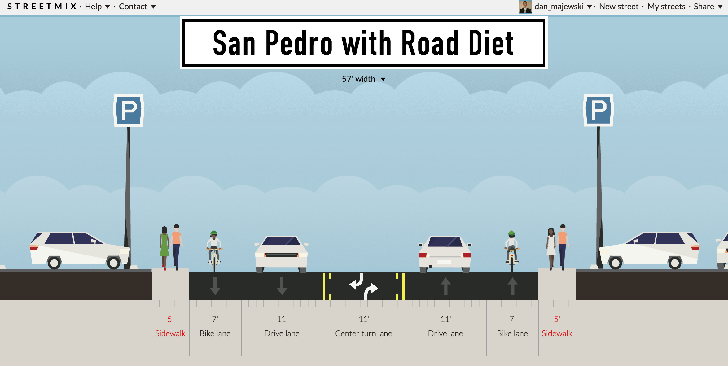
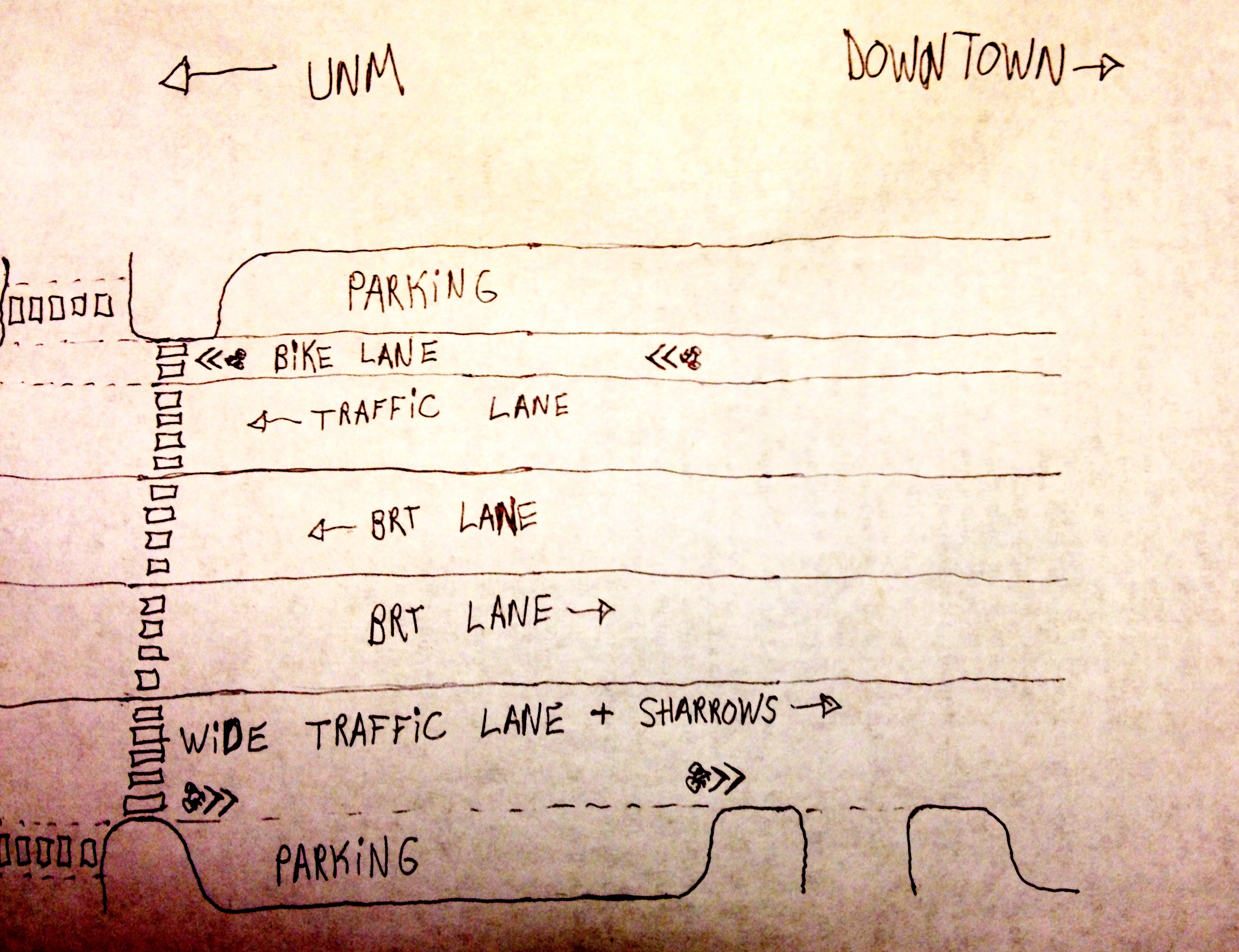
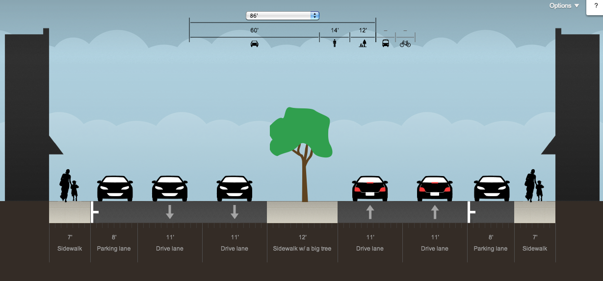
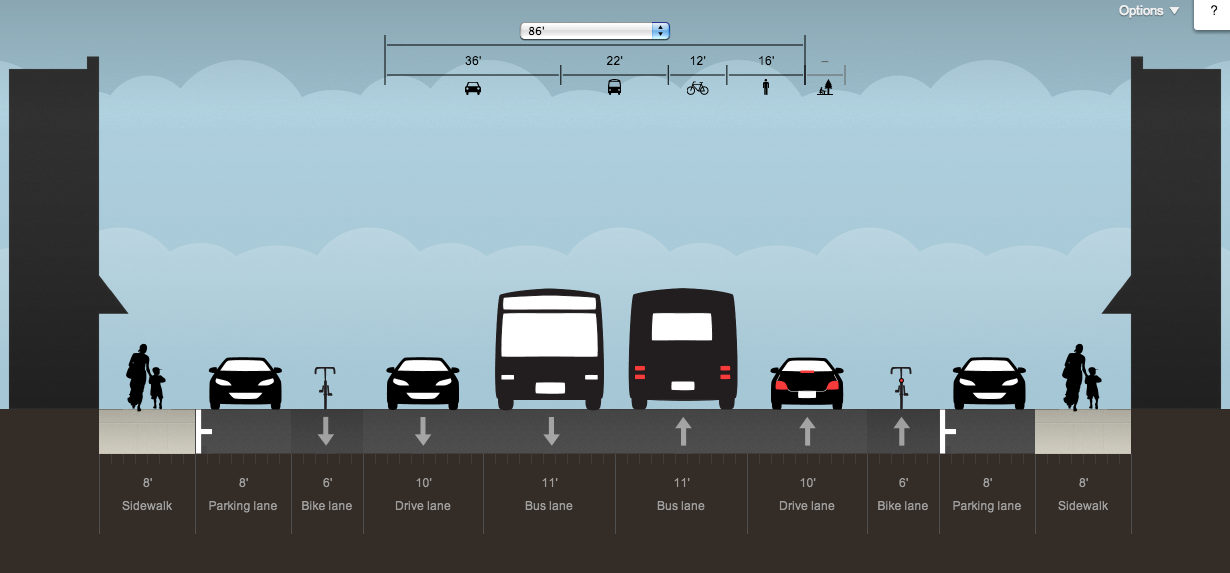
Improving Dedicated Busways 

ART’s dedicated bus lanes are a key component of its success, but there are areas where they can be improved. For example, in sections where ART runs in a shared or dual-directional busway, many passenger vehicles become confused and cross the lane, which can be dangerous. One solution that could be employed on these dual-direction busways is to install short, center-running curbs that are low enough for the buses to straddle, but high enough to direct traffic from side streets from crossing Central Avenue. Examples of this exist on Indianapolis’s Red Line, another BRT project built at the same time as ART. In addition to the bi-directional lanes, ART would benefit from dedicated lanes on Copper and Gold downtown. Though these lanes would replace parking spots, it would help increase speed for ART through the downtown core. A queue jump heading east from 10th Street may also help ART vehicles circumvent congestion that can happen at 8th, Central, and Park, particularly when cruisers are taking to the streets (though recent closures of the roundabout that essentially divide the circle in two have helped alleviate this concern on Sundays). 

Example of the center curb used in the bus lane in Indianapolis, from The Fox and the City. Read their great look into Indy’s new BRT.
An ART Bus stopped at the Main Library Station at 6th and Copper, where ART would benefit from dedicated lanes through Albuquerque’s core. 

Future Expansions of ART are Needed

The changes mentioned above are changes that are all readily available to be implemented quickly. But what about further down the line? We have already seen how ART is helping to change land use and increase safety, transport efficiency, and job accessibility. These are not changes that need to be constrained to the present ART Corridor. At present, several important job centers and corridors are absent from ART service, including the Montgomery corridor, much of 4th Street, Cottonwood Mall, and the Journal Center. 

A quickly done, imagined service map of what a wide-running ART System could look like.

Imagine an ART line connecting the Sunport or Downtown with the Journal Center and the Westside. In addition to these areas, a key restraint to more development of multi-family housing at Mesa del Sol is the lack of high-capacity transit. A common complaint about ART is that Central Avenue already had good transit and that the money should have been invested to improve transit elsewhere. Though we have touched on why it was appropriate to develop Central Avenue first, the heart of the critique IS very relevant. Much of Albuquerque DOES need more investment and there are people who would happily leave their car at home if it was more convenient for them to do so. The City’s “ABQ Ride Forward Initiative” is currently looking at ways to rebalance the bus network so that wider parts of the city would have greater access to frequent bus lines. This is definitely a step in the right direction. However, the initiative is simply a rebalancing, moving around current infrastructure without adding anything new. What would investing more in the transit system look like?

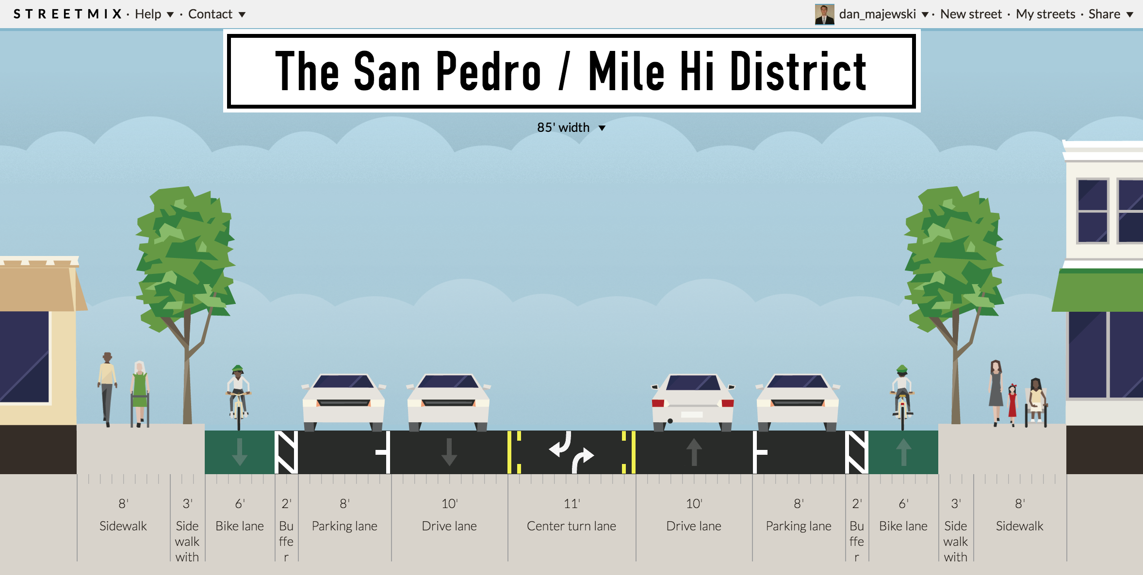
ART Can Catalyze the Creation of “Urban Villages”

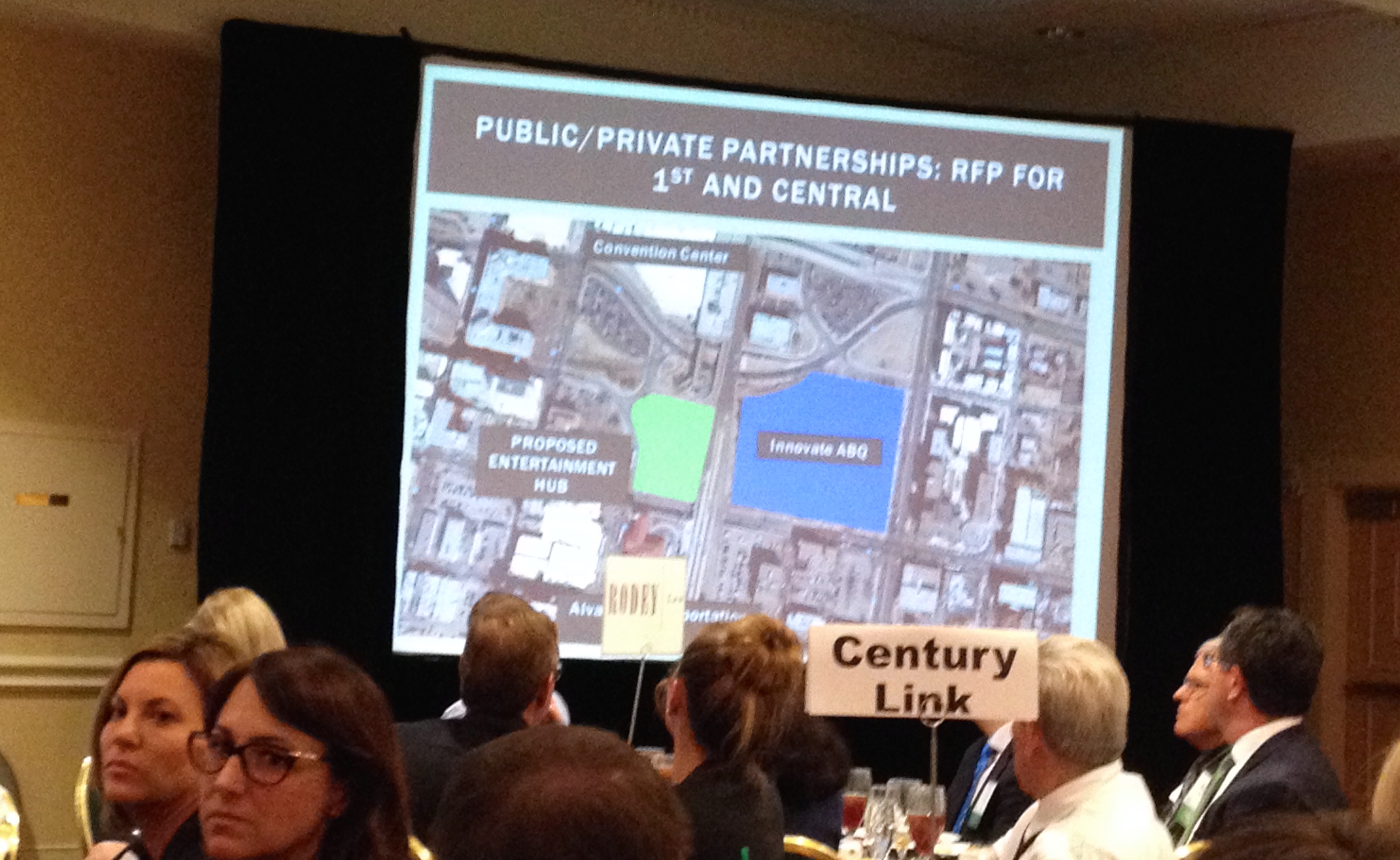
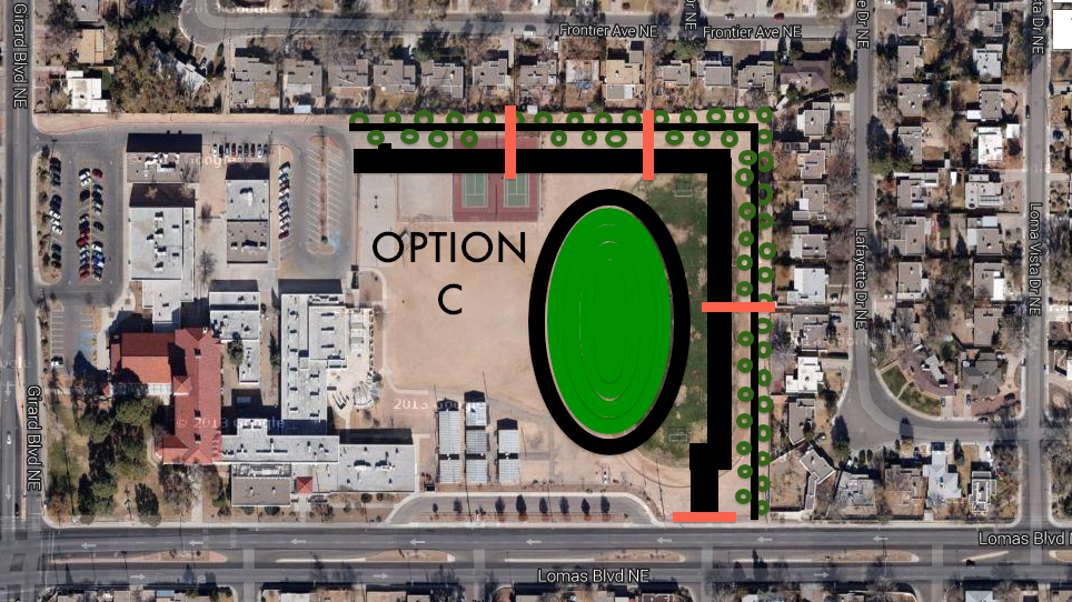
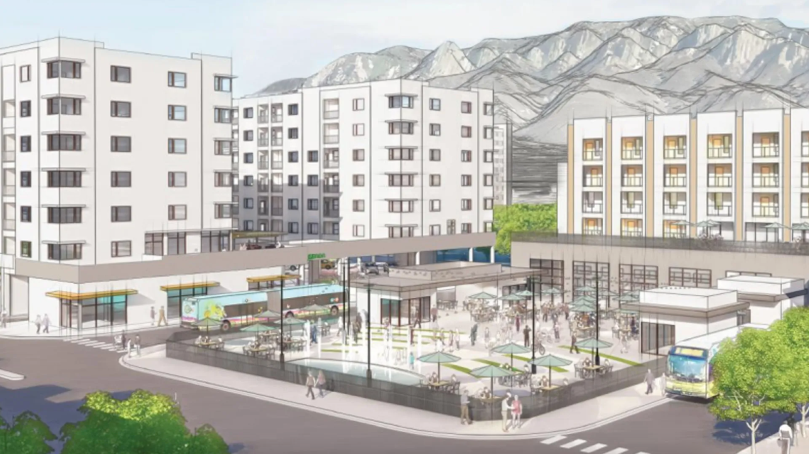
With an expanded ART network, we could begin reimagining areas of the city so that amenities, housing, retail, and employment opportunities could be accessed over a wider territory. Creating what are called “urban villages,” mixed-use areas with medium to high density that can anchor otherwise suburban areas, is a strategic approach to fostering sustainable urban development and vibrant communities. In Uptown, we are slowly seeing the district infill with new apartment buildings, hotels, and amenities. Winrock Town Center may very well become a new urbanist infill project, in addition to the Uptown Transit Center being rebuilt as mentioned before. As Uptown slowly becomes an urban center in its own right, we should imagine how we can create urban villages in other areas of the city. Imagine how a rebuilt, enhanced ART Blue Line could help transform the area around Cottonwood Mall. Currently, the Cottonwood Mall area is a crossroads of the West Side, connecting various West Side neighborhoods to nearby metro communities like Corrales and Rio Rancho. It is home to one of the largest high schools in the region and near the Southwest Indian Polytechnic Institute. A new ART line could help densify this area, adding options for employment, entertainment, and commerce, and over time, alleviating cross-river commutes. 

Images above, from the book Sprawl Repair Manual

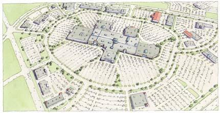
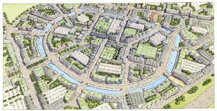
The images above paint a picture of how Cottonwood and other areas of the city could be reimagined as new “urban villages,” serving as hubs within sectors of the city. With a good rapid transit system connecting them, Albuquerque would be much better suited to meet the challenges and demands of the 21st century. 

Improved Regional Connectivity

If you are a New Mexican living far from Albuquerque with a chronic illness such as cancer, HEP-C or HIV, it is likely that you travel into the city regularly for continued treatments. Albuquerque serves as a regional healthcare and services destination hosting some of the only specialized medical, educational, and business centers in the state. It isn’t uncommon for residents in underserved outlying communities to delay care or other activities due to a lack of transport and means. Good public transit inside the city can help create the environment to better support regional transit as well. As Rio Metro slowly improves the Rail Runner to (hopefully) run hourly throughout the day in the next decade, that could bring additional rider demand into the city. But what do you do once you get to, say, Montaño Rail Runner Station?

An expanded ART could better connect the Rail Runner to regional job and services hubs at UNM Health Sciences Center, Journal Center, Cottonwood, and Sandia National Labs, as well as other areas that aren’t necessarily surrounding a station. Suddenly, a lot of those motorists from Santa Fe, Los Lunas, and Los Alamos who did not want to deal with a 40-minute bus ride or a $20+ Uber have options, lessening congestion on I-25 and improving environmental outcomes. With improved regional bus and rail connections, these benefits can extend to underserved populations, who desperately need fewer barriers to accessing care, education, and opportunities. Many New Mexicans would love to have expanded rail and bus options from Albuquerque and expanding ART can help lay the groundwork to make that possible. As the state’s central hub for just about everything, we can leverage ART to help promote better health outcomes and economic prosperity throughout New Mexico. 

An ART bus arrives at Alvarado, where it interchanges with Rail Runner, Amtrak, and Greyhound Bus Lines. 

Where Should ART Expand Next? 

Let us know in the comments below, or reach out to the team at UrbanABQ for further discussion!

*BRT Ridership for Cleveland Health Line reflects passenger numbers as of May 2023.

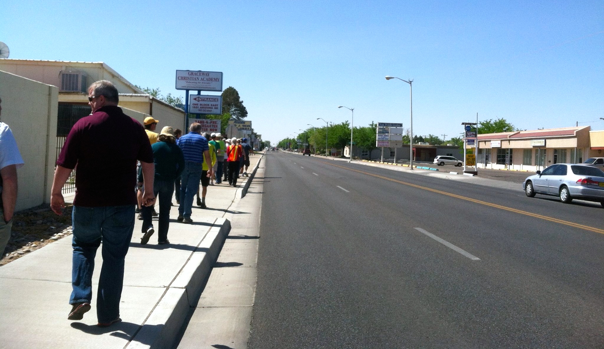
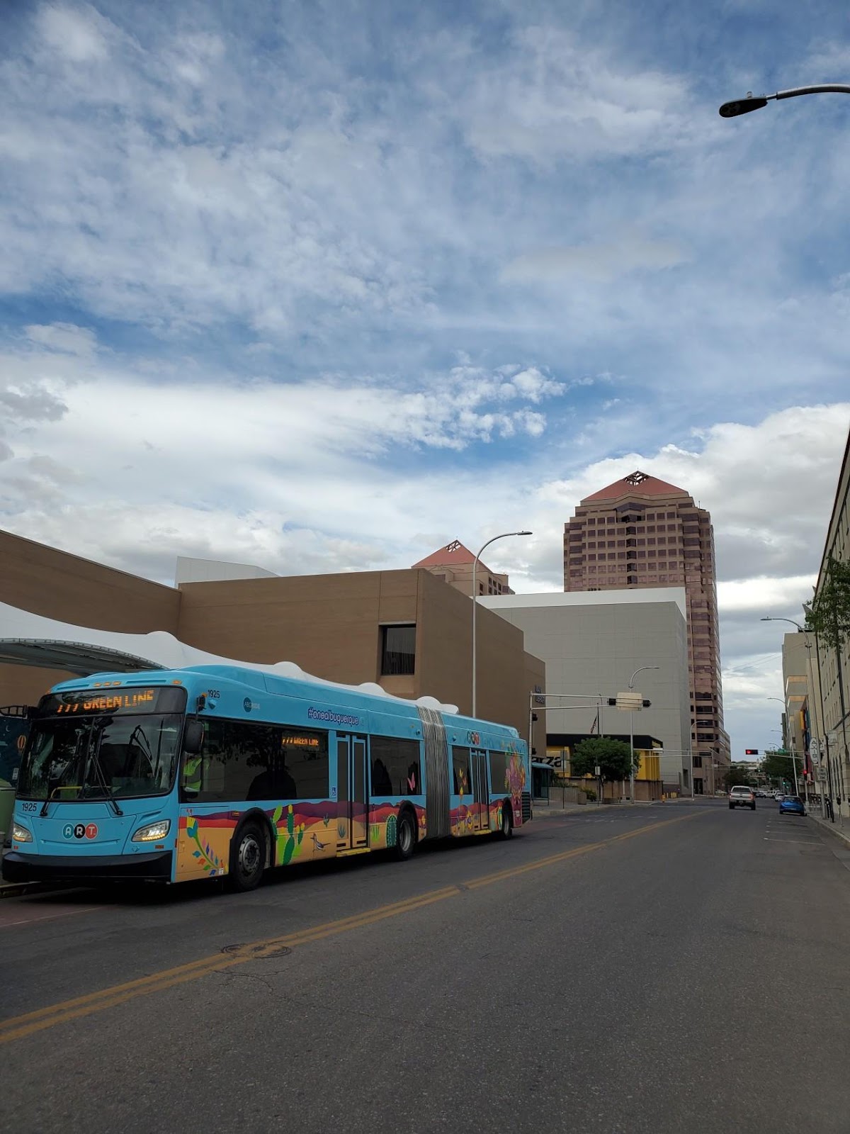
All photos of ART were taken by the author.

Dan Burden, San Pedro Road & the Paradigm Shift: Rebuilding the Local Economy in ABQ Through Better Design

– Dan Majewski

Dan Burden leading one of his famous "walking audits" on Constitution Road, ABQ, NM.
Dan Burden leading one of his famous “walking audits” on Constitution Road, ABQ, NM.

The recession has not been kind to Albuquerque.  Since 2008, a massive shift in consumer preferences and economic activity has left the traditional economy in shambles.  As other cities and states “recover,” Albuquerque continues to hemorrhage jobs and young, educated millennials.

Desperation Leads to Collaboration

Some would see the above statement as negative and currently, in the short term, it is.  However, it’s also an incredible opportunity.  The longer we go without a “recovery,” the more we are forced to collaborate on local sustainable solutions.  The city, UNM and CNM are finally beginning to understand this.  An example is the Innovation Central project, a collaboration between several agencies in the region.  This can been seen on the micro level as well with children moving back in with their parents.  Again, this is a potential positive: multigenerational families can share labor, ideas and collaborate more effectively.  Grandma can watch the kids while mom works.  On the flip side, mom can show grandma how to use the computer.  Most cultures operate this way and it’s a healthy way to exist.

An image from a NAIOP presentation about the mayors proposal for the Innovation Center in Downtown ABQ.

Drive ’till You Qualify… For Food Stamps

I could go on, but I want to jump to a larger problem: infrastructure, specifically transportation infrastructure.  We have built a civilization that is impossible to navigate without an automobile.  This is inherently discriminatory: over 1/3 of our society cannot / does not own an automobile.  As our society ages, this problem will only accelerate.  Young, elderly, poor… a huge percentage of our society, stranded in the suburbs.

This brings me to the lessons of Dan Burden, people street specialist.  Thanks to the generous contributions from AARP, UNM, the Mid-Region Council of Governments and other partners, the Complete Streets in New Mexico Leadership Team hosted Dan Burden in Albuquerque on May 16-17.  His analysis focused on San Pedro Road and Constitution Avenue in the Fair Heights and Mark Twain neighborhoods.

Who is Dan Burden?

Dan is famous for several reasons.

  • Walking audits

The field of planning, or any field for the matter, is dominated by meetings behind closed doors in badly designed windowless buildings.  This environment leads to equally closed minds.  Dan throws all of that out the window, gathers everyone together and takes them on a walk.

On these walks, Dan uses the crowd to teach lessons.  For example, during our walking audit in the Mark Twain neighborhood, Dan used the audience to create a human traffic circle.  A car approached and drove around us, carefully and safely.  Lesson learned.  No long, complex jargon filled explanation was required.

A custom Dan Burden Human Traffic Circle, here in ABQ.  - Photo: Valerie Hermanson
A custom Dan Burden Human Traffic Circle, here in ABQ. – Photo: Valerie Hermanson

A Dan Burden walking audit is a form of street theater.  He is famous for throwing a tape measure into the street, disregarding oncoming traffic.  Dan does this to make a point, to teach a lesson and to draw attention.  He takes measurements in real time and explains why the design leads to bad behavior and points at actual observed examples.

What does this have to do with our local economy?

Let’s start with automobiles.

According to the Victoria Transport Policy Institute, regions with high level of automobile dependency experience economic detriments compared to regions with a more balanced transportation system (Source: page 6)

This is a point I have discussed in previous posts, especially in my article about Indian School: high speed traffic not only kills people, but it also destroys our local economy.

Regarding San Pedro, it is an economically depressed corridor in large part due to the ineffective and inefficient transportation infrastructure.  Mr. Burden proposed a solution.

  • Road diets

The blue line on this map highlights the segment of San Pedro which requires change.

This is also a Dan Burden innovation.  It’s powerful because it only requires paint.  For the modest investment of $40,000 (~$15,000/mile, 2.5 miles, source: scroll to bottom of page), San Pedro can be redesigned with people in mind.

A road diet on San Pedro would take the current 4 high speed traffic lanes and convert them to 3 lanes + bikes lanes on each side.  One of the three lanes would be a center turn lane with opportunity to build medians and concrete crosswalk islands.

In addition, a road diet allows for safer and more efficient movement of automobiles.

This is a diagram of San Pedro today.  No bike lanes, narrow sidewalks and no easy way to make a left turn.
This is a diagram of San Pedro today. No bike lanes, narrow sidewalks and no easy way to make a left turn.

Here’s an example: Today, if a vehicle wants to make a left turn from San Pedro onto another street, they have to stop in the middle of traffic.  People behind them have to stop.  Sometimes, they aggressively switch to the right lane instead.  This leads to dangerous, high speed crashes.

Because of this bad design, it is difficult and dangerous to access businesses on San Pedro.

The most important thing to understand about a road diet: the stakeholders who stand to benefit the most are the business owners!  Some of the businesses owners on San Pedro are resistant towards road diets because they perceive them to be a “reduction in capacity”.  A road diet actually leads to an “increase in efficiency”.  Providing a center turn lane makes it far easier to both access businesses and move vehicles through the corridor.

Another benefit is a large reduction in speed.

Why is this so beneficial?

For Bicycles and people on foot: slower speeds = safer crossings and corridors.  A collision at a speed below 20 MPH is almost never fatal.  At 40 MPH, it’s almost always fatal.  A slower corridor is a safer corridor and a safer corridor leads to an increase in people walking and biking.

Notice how far people are walking from the curb in fear.  Vehicles frequently move at 50 MPH+ on this street, San Pedro. - Photo: Valerie Hermanson
Notice how far people are walking from the curb in fear. Vehicles frequently move at 50 MPH+ on this street, San Pedro. – Photo: Valerie Hermanson

For businesses: Dan Burden says that the ideal speed for a businesses district is 19 MPH.  At this speed, motorists have enough time to see a businesses, slow down and park.  This leads to local commerce and a more vibrant corridor.

This image shows how with the same amount of space, you can effectively move traffic and improve access for everyone.  Added benefit: the bike lane buffers the sidewalk from vehicle traffic.
This image shows how with the same amount of space, you can effectively move traffic and improve access for everyone. Added benefit: the bike lane buffers the sidewalk from vehicle traffic.

How can we, as a community, make the San Pedro Road Diet happen?

There are a few barriers to this project.  However, there is huge support for it as well.

SUPPORT: The Mark Twain and the Fair Heights neighborhoods are organized together in support of this project.  The Dan Burden event took place at Mark Twain Elementary School.  The principal of the school attended much of the workshop and he was very supportive of everything discussed.  The recently elected City Councilor for the area, Diane Gibson, attended as well.  She also stayed after the presentation to speak one-on-one to some of the louder voices of resistance in the room.

RESISTANCE: There a two primary voices of resistance against this project.  One of the voices is a collection of businesses owners along the corridor.  They feel that reducing vehicle lanes = reduction in traffic = reduction in businesses.  As we’ve read above, this simply isn’t true.  Luckily, this is a problem that can be solved through education.  It will not be easy but it’s certainly doable.

The other much louder voice comes from the City of Albuquerque Department of Municipal Development (DMD) – Traffic Engineering.  During this conference, we heard from the traffic engineers that a road diet on San Pedro was essentially impossible because of traffic counts.  They used the word “failure,” implying that changing the road in any way would cause the sky to fall.  In engineering language, the “failure” of a road means that traffic will come to a standstill.  The question I wish I had asked:

For what percentage of the day would San Pedro be in “failure”?  2 hours?  30 minutes?  5 minutes?

For most of the day, San Pedro is empty.  Based on what was said, the engineers intend to design a road that functions well for a small percentage of the day and badly for the majority of the day.  On top of this, vehicle miles driven (VMT) locally have been dropping steadily since the early 2000s and transit ridership locally has doubled in the past decade.  This trend will continue as our population ages and mass transit improvements are made.  San Pedro also has redundancy.  There are several parallel roads with space to absorb a few extra cars per day. This voice of resistance will be more difficult to defeat.  We as a community must work together to patiently educate and explain to these engineers that the decision to prioritize motor vehicles is destroying our community.  Adding safe bicycling facilities and reducing traffic speeds should be the top priorities for traffic engineers working on our local streets.  Luckily, according to Dan Burden, once a single road diet happens, the barriers crumble and they become common place across the community.

THE VISION: Below, is an idealized image of the Mile Hi District.  This is the historic name of the business cluster on San Pedro between Lomas and Constitution.  The name is the result of the elevation of this area being exactly a mile above sea level.  Restoring this historic brand will be an important part of reinventing this potential filled corridor.  Linked here are more redesign proposals for San Pedro.

The image below has it all: buffered bike lanes, nice buildings, wide sidewalks, on-street parking, etc.  The final product might not have all of these elements but we need to work as a community to include as many of these elements as we can.

THE CHANGE: It’s time to change how we think about transportation in our community.  We all gripe about how Albuquerque is a “car town” and this is the opportunity to turn things around.  If data is collected properly, this project could set the stage for a major transition in our community.  In a place with such temperate weather and 300+ days of sunshine, it is unacceptable that we are unable to walk or bike safely to most destinations.

What do you want to see on San Pedro?  This may look impossible or unrealistic but plenty of communities have accomplished projects like this.
What do you want to see on San Pedro? This may look impossible or unrealistic but plenty of communities have accomplished projects like this.

TAKE ACTION!  

Contact Councilor Gibson and tell her you support this action.  The squeaky wheel gets the grease.  If the support is more vocal than the resistant business owners, this project WILL happen.

Councilor Diane G. Gibson: dgibson@cabq.gov
Policy Analyst Chris Sylvan: csylvan@cabq.gov
Phone: (505) 768-3136

When an issue receives just 10+ emails or phone calls, it becomes a high priority one.  Send out links to this post to anyone who you feel could influence policy on this issue.

Thanks for reading and keep on pushing for positive change in your community.

Jeff Speck + Jefferson Middle School: Improving a Problematic Proposal

– Dan Majewski

Click this image to visit HaltTheLoop.com

NOTE: Jefferson Middle School may soon fall to the bulldozers and a loop road will be constructed around the school. This proposal has been pushed through without any public process. If you have an interest in learning more about this issue or preventing it from happening, click the image above to visit HaltTheLoop.com.

On the evening of August 14, the renowned urbanist and author Jeff Speck lectured at the Hotel Parq Central. The attendees were a diverse mix of community members including city planners, developers and other interested citizens. Mr. Speck’s ability to speak candidly about the issues facing Americas urban communities was refreshing and helpful. His new book, Walkable City, outlines in detail many of the themes highlighted in his presentation. If you are interested in making Albuquerque or any city more economically sustainable and physically healthier, I strongly recommend this book. It is light on the jargon yet it clearly highlights the ingredients necessary to create cities for people.

Mr. Speck Goes to Jefferson
The next morning, I joined Jeff Speck and a couple of other community members on a tour of Jefferson Middle School. The discussion topic was a proposed loop road around the perimeter of the school. I previously wrote an article about this issue titled Why Don’t Children Walk to School Anymore? Crisis and Opportunity at Jefferson Middle School.

We arrived at the school around 8:10 AM during the peak of the morning parent drop-off rush. It was relatively tame on Girard: slow speeds, minor congestion and relatively fluid movement. Once we entered the adjacent neighborhood, the issues became more visible with high volumes of parent drop-off traffic observed. This created potentially dangerous situations for the many students and residents walking or biking on these streets.

We parked and entered the school grounds from one of the three walking paths which connect the neighborhood to the school. The loop road plan was briefly explained to Jeff and as we walked he began to draw.

Mr. Speck observed that there was very little traffic on Lomas considering it was the peak of morning rush hour. Sure enough, the traffic counts show that this segment of Lomas is overcapacity and does not need three lanes in each direction.

Lomas could easily lose a lane between Carlisle and Girard

For comparison in the image above, observe that Central, highlighted on the bottom of the image with a black rectangle, handles almost twice the amount of traffic (31,200 cars/day) between Girard and University with only two lanes in each direction. I encourage you to play with the large full version of the traffic count map in the image above: 2011 Traffic Flows for the Greater Albuquerque Area.

In just 45 minutes, Mr. Speck quickly sketched out three alternatives to the loop road which were far superior to anything presented by APS. They are as follows, beginning with least expensive/physically easy and ending with most expensive/physically difficult:

Click to enlarge!  This image illustrates the conversion of the existing right lane into a pick-up / drop-off lane
Click to enlarge! This image illustrates conversion of right lane into a pick-up / drop-off lane

OPTION A: Blub-Out on Lomas = Traffic Calming, Lower Speeds
This plan would be both incredibly cheap and physically easy to implement. Regarding physical infrastructure, it would only require a bulb-out (COST: ~$20,000; source) and pavement markings instructing vehicles where to stack, where to turn, etc. Compare this to the cost of the proposed loop road at $572,000. The graphic above explains Option A in detail. As written in the graphic, this segment of Lomas only averages 17,400 cars/day! This volume of traffic could easily be managed with only two lanes vs. the existing three lanes.

A major side benefit of this plan would be reduced speeds and traffic calming. One less traffic lane would give vehicles one less opportunity to pass aggressively, making it safer and easier for people to cross the street.

Click to enlarge!  Speck's sketch of Options A and B
Click to enlarge! The J. Speck sketch of Options A and B

Click to enlarge!  This image shows the space available to enlarge the existing bus drop off area
Click to enlarge! This image shows the space available to enlarge the existing bus drop off area

OPTION B: Extended Bus Drop-off Lane
According to neighborhood residents, Lomas is only serviced by four school buses. However, the bus lane is wide and if extended, could easily handle the existing four buses as well as a significant percentage of the parent pick-up/drop-off traffic. The graphic above explains this alternative in more detail. Since this option would involve extending something that already exists, the cost to build it would be much lower than the proposed loop road.

Click to enlarge!  In my rough illustration, the red rectangles represent the enhanced crossings proposed by Jeff Speck.  A tree lined sidewalk skirts the outer edge of the project area
Click to enlarge! In my rough illustration, the red rectangles represent the enhanced crossings proposed by Jeff Speck. A tree lined sidewalk skirts the outer edge of the project area

OPTION C: Tree Buffered Loop Road + Enhanced Crossings + Narrowed Pavement
This option, pictured above, would require the least amount of deviation to the existing plan. However, the enhancements discussed here would lead to a much higher quality project.

The image below was drawn by Mr. Speck. In his drawing, the proposed 24 ft. road has been transformed. Mr. Speck proposed:

12 ft driving lane +
8 ft. gravel parking lane +
6 ft. tree buffer +
6 ft. sidewalk +
6 ft. tree buffer

Click to enlarge!  The right side of this image, drawn by Speck, details proposed new alignment
Click to enlarge! The right side of this sketch by Speck details the proposed new alignment

A 12 ft. driving lane plus an 8 ft. parking lane vs. the proposed 24 feet of pavement would mean lower speeds plus less storm water drainage issues.

The tree lined sidewalk would both reduce the heat island effect of the new road and provide a pleasant walking environment for the significant percentage of students who walk to school.

Another critical element of the Speck plan is raised crosswalks at all three of the neighborhood pedestrian cut throughs plus the two ends of the road. Below is an illustration of a raised crosswalk:

A hybrid crosswalk and speed table, raised crosswalks are a great way to slow down traffic and provide safe crossings

Creating Places for People
Jeff Speck saw the issues at Jefferson Middle School and quickly found cheap, easy and reasonable solutions to the current problem. Regarding Option A, Jeff Speck made this point:

If we think in isolated boxes, we are fixing a school drop off problem by creating a traffic problem. If we think synthetically, we are fixing two problems at once: school drop off and an unsafe sidewalk against speeding traffic.

This project is interesting because of the larger context. APS is one of the most influential organizations in the City of Albuquerque. If they do not have an interest in encouraging walkable environments around their schools, the whole city loses. Regarding walkability, schools and children are the lowest hanging fruit. By design, most student live in close proximity to their school, especially if it is a middle school or an elementary school. Encouraging walkability is simply good economics: parking lots and loop roads are a lot more expensive than crosswalks and bike lanes.

Jefferson Middle School has a history of students walking and biking to school. Though a significant percentage of students are now attending from outside the district, there is still plenty of opportunity to encourage walking and biking.

Since APS does not have to answer to any higher authority, they are acting in a disrespectful manner. They refuse to acknowledge all of the better options that could be used to solve the parent drop-off/pick-up problem. They want the project to be completed and for the neighbors to get out of the way.

The city has not yet granted the curb cut that Jefferson/APS needs in order to complete the road but the writing is on the wall. Within the past couple days, fences and other infrastructure have been placed, suggesting an imminent start to this project.

It is unfortunate that APS does not want to build a good relationship with its neighbors. It is a missed opportunity and it will leave behind bad blood in the neighborhood for years to come.

TAKE ACTION!
Come to the Albuquerque City Council meeting tonight (August 19) at 5 PM and speak up for progressive walkable urbanism in Albuquerque!

Central Avenue: The Necessity of a Strong Vision, Community Champions and Street Trees

UPDATE 2/4/16: Last night, the City of Albuquerque hosted a meeting about this BRT project on Central, now called ART. See the project website here! Many new and updated features of the project were unveiled at the meeting including pedestrian scale lighting along the entire project corridor and FREE high speed WiFi!

We will be learning if ABQ receives the federal grant for this project in less than 1 WEEK, on February 9th!

Many people believe project has been “fast tracked” without any public input. Part of why we’re reposting this article from 2013 is to disprove that point. Also, many of the concerns voiced in this article have been addressed including:

Bikes and Silver: The City has planned and begun allocating funding for improvements to Silver. This does not mean that Silver will extend past the freeway. However, the city is also going to be making major improvements to bike facilities on MLK, already a heavily used bicycle corridor that connects UNM to Downtown. We still believe that there are unanswered questions about bikes on Central but overall, many improvements to the plan have been made.

Medians vs. Wider Sidewalks: The folks in Nob Hill came to an agreement with the project planners and there will be wider sidewalks through Nob Hill instead of medians, a huge improvement for the business district. In fact, sidewalks will be widened and improved throughout much of the corridor and pedestrian scale lighting will be added throughout the entire corridor!

Marketing, Outreach and Champions: This project has found a champion in the form of Mayor Berry.

However, outreach and marketing by the City on behalf of this project has been too little, too late. Unfortunately, outside sources have spread misinformation about the project. Independent from those outside sources, there has been resistance to the project for a variety of reasons. In addition, it is not always easy to communicate the benefits of this project, the construction process, the potential impacts and other aspects of this proposal.

The people running this project, as of very recently, finally starting using a Facebook page to communicate information. The City needs to do better promotion and outreach for these types of projects to get ahead of any possible pushback or misinformation campaigns. It’s not an easy thing to do but it can be done.

There’s plenty more to be said about this project and we will continue discussing it on our Facebook page.

The original article, in it’s unaltered form, is below:

“Central Avenue: The Necessity of a Strong Vision, Community Champions and Street Trees”

-Dan Majewski, May 2013

BRT meeting, ABQ Museum

During the month of May in 2013, the City of Albuquerque held six public meetings about a proposed Bus Rapid Transit (BRT) system for Central Avenue. Every meeting was held in a different location and focused on a different segment of the proposed project.

The format of the meeting was as follows:

  • 15 minute power point presentation about BRT + benefits of the project + why it should be built
  • 30 minute collaborative work session: we broke into small groups and conversed with consultants about what we like on the corridor, what we don’t like, what type of project alignment we would like to see, etc.
  • 15 closing presentations by each of the small groups

The collaborative element was useful. It allowed us to effectively express our opinons and hash out a vision for the corridor. It was also an opportunity to air grievances without having to interrupt the larger group presentation.

Bus Rapid What?

BRT Rendering

I attended two of these meeting and came away with mixed feelings.  BRT could be a great solution to the current transportation problems currently found on Central Avenue but it must be marketed correctly and executed properly.  Scroll to the bottom of the article for my full reaction.

Sorry, No Bicycles Allowed

For rapid transit systems to work, they must attract people from a wide geographic area.  To accomplish this, bicycles can be a great tool.  When asked about bicycles at this meeting, many of the consultants or city leaders implied that bicycles do not belong on Central Avenue.  “Why not the Silver Bicycle Boulevard?  Or MLK?  Or Lead/Coal?” they would say.  My response:

  1. Silver is great… until it dead ends at I-25.  It does not connect the University of New Mexico to Downtown, Old Town or the Bosque Trail.

    As you can see, the Silver Avenue Bicycle Boulevard ends at the interstate.
    The blue line on this map is the Silver Avenue Bicycle Boulevard. As you can see, it currently ends at the interstate freeway on the left side of this image.
  2. Most of the desired destinations are located on Central.  I may use Silver for 90% of my trip.  However, since my end destination is located on Central, I need to bike on Central for at least a block or two.  This means riding on the sidewalk (dangerous/illegal) or in the street (terrifying).
  3. Whether you like it or not, there is already a lot of bicycle traffic on Central.  It will only increase over time as this corridor becomes more dense.
  4. Accommodating bicycles does not necessarily mean 6 foot bike lanes in each direction.  It simply means providing infrastructure where possible.  This is an example of what bicycle accommodation could look like in the narrow segment between University Boulevard and I-25:

central

The Nob Hill No

The Nob Hill Neighborhood is the most organized and wealthy stakeholder group on this corridor.  They are also the most frustrated and angry about this proposal.  From their perspective, CABQ is trying to take away something (the medians) which presently provide safe pedestrian refuge.

True BRT = one general traffic lane in each direction.  This would lead to slower traffic speeds, creating a safer pedestrian environment and reducing the need for median pedestrian refugees.  However, the city has not adequately demonstrated the exchange of the medians for a world class rapid transit system.  The project leaders have not clarified how many crossings for people on foot would exist along the segment.  Also, it appears to Nob Hillers that this system will simply be going through the neighborhood without stopping (as the current alignment exists).  CABQ and ABQ Ride are not effectively selling the system to the neighborhood.

The city should explain that instead of the medians, Nob Hill could get wider sidewalks or bicycle lanes.

Using Streetmix, here’s how the Nob Hill segment currently looks:

Streetmix: nob hill current

Here’s how this segment could look with bicycle lanes:

Nob Hill, bike lane option

It could also look like this, replacing bicycle lanes with wider sidewalks:

Nob Hill; BRT + street trees

There are many potential positive possibilities.

Lessons from Ft. Collins, CO

On February 21st, the ULI (Urban Land Institute) hosted a full day conference about BRT in Albuquerque called Transit and Place: First Steps.  The day was filled with fantastic presentations from transit providers and developers nationwide.

Kurt Ravenschlag from Ft. Collins, CO delivered a wonderful presentation about the Mason Street Corridor BRT Project.  Initially, the project did not go over well in this mid sized college town.   It was rejected by the business community because the city was not emphasizing the economic benefits of the project, such as increased values around the station areas.   The transit provider was forced to go back to the drawing board.  The re-marketing of the proposal was successful and the project is now being constructed with major local support.

The City of Ft. Collins did not change the project!  They only changed the sales pitch.

All Together Now

The City of Albuquerque is currently working on a Complete Streets Plan for Central Avenue between 1st St. and Girard.  Isolated from the BRT project, this plan has its own webpage, a separate set of public meetings and different group of consultants.

This needs to change.

The BRT plan and the Complete Streets plan are the same thing!  They both have the same vision: increased economic development and a safer more beautiful street for people moving throughout the corridor.  Why are there two separate plans?

Mr. Ravenschlag from Ft. Collins emphasized the importance of first laying out a vision for the corridor.  Streetscaping should be the first conversation, followed by zoning overlays and bicycle/pedestrian access.  After all of that, transit should be discussed.

Reframing the Conversation

Central Avenue is in desperate need of a solution.

Half of all transit trips in the city are on this corridor.

It is Albuquerque’s main street but it is marked by vacant lots, visible poverty, fast moving automobile traffic, high pedestrian fatality rates, unsafe intersections and a lack of cohesiveness.

Rapid transit will be a part of the solution but it can not come at the expense of all the other elements.  Wide shaded sidewalks, bicycle infrastructure, rezoning of the corridor, reduction of parking minimums and safe pedestrian crossings at every intersection are all more important to the long term success of Central Avenue.

This project needs a stronger emphasis on the complete streets and economic development elements of the project.

ABQ Ride and the City of Albuquerque need to go back to the drawing board and figure out how to sell BRT as a larger part of the revitalization of the Central Avenue corridor.

The sales pitch could be something like this:

IMAGINE… an improved Central Avenue, Albuquerque’s Main Street.  Envision wide, smooth, safe sidewalks shaded with large native street trees.  Think of slow moving vehicle traffic and narrow, easy to cross intersections.  Visualize vacant lots disappearing, then filled with shops next to the sidewalk and apartments above.  Feel the warm summer air as you leave your apartment and walk a few steps away to a rapid transit station.  The station has shade, real time arrival information and other amenities.  However, you barely have time to look at all of it since a transit vehicle arrives every five minutes.  The successful vibrant Albuquerque of the future is linked to this critical corridor.

Can you see it?  I sure can.  For it to manifest, it will take strong local champions and a chorus of voices demanding a safer, more prosperous and more beautiful Albuquerque, a city for PEOPLE, where motor vehicles are guests.

It’s a difficult challenge but it’s our best hope for long term economic vitality.

Get involved!

Please comment below if you have questions or comments about this post.

For more information on the Central Avenue BRT project, click this link.

For more information on the Central Avenue Complete Street Plan, click this link.

Like the Complete Streets in New Mexico Facebook page for more news and information.

Like UrbanABQ on Facebook for more news and information.

Parklets Hit the Primetime

this one!
Channel Four News aired a segment last night about parklets. Tim Trujillo gracefully covered the subject in the video segment, explaining the social and economic benefits of having safe and pleasant places to hang out and spend time Downtown. Here’s a link to the full article and video.

In cities where parklets have already been built (such as NYC and San Francisco) local businesses were not initially supportive. Once businesses realized people spent more money in places where they could safely sit, demand for parklets and plazas increased. For example, in Times Square NYC, a large portion of Broadway Blvd. was converted into a plaza in 2009. Since that change occurred, retail sales and rent values have skyrocketed (Streetsblog NYC). All over America and the world, residents and planners are realizing that people are the key to successful places and spaces; cars are secondary. Soon, Albuquerque will join a group of great American cities that prioritizes space effectively and reallocates space from cars to people without much more than a signed piece of paper. Until that moment, we must all join together and tell our city what we want.

Albuquerque is NOT for cars; it is for us, people, Burqueños. We want to walk and bike and use all of the streets safely. Our city leaders understand this but they need to hear the message more forcefully. Other cities across the country are beginning to realize that endless low density sprawl is a recipe for economic disaster. A strong core is key to the success of a metro area and parklets are a step in the right direction.

-Dan