Category Archives: urban

Jeff Speck + Jefferson Middle School: Improving a Problematic Proposal

– Dan Majewski

Click this image to visit HaltTheLoop.com

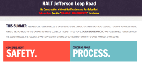
NOTE: Jefferson Middle School may soon fall to the bulldozers and a loop road will be constructed around the school. This proposal has been pushed through without any public process. If you have an interest in learning more about this issue or preventing it from happening, click the image above to visit HaltTheLoop.com.

On the evening of August 14, the renowned urbanist and author Jeff Speck lectured at the Hotel Parq Central. The attendees were a diverse mix of community members including city planners, developers and other interested citizens. Mr. Speck’s ability to speak candidly about the issues facing Americas urban communities was refreshing and helpful. His new book, Walkable City, outlines in detail many of the themes highlighted in his presentation. If you are interested in making Albuquerque or any city more economically sustainable and physically healthier, I strongly recommend this book. It is light on the jargon yet it clearly highlights the ingredients necessary to create cities for people.

Mr. Speck Goes to Jefferson
The next morning, I joined Jeff Speck and a couple of other community members on a tour of Jefferson Middle School. The discussion topic was a proposed loop road around the perimeter of the school. I previously wrote an article about this issue titled Why Don’t Children Walk to School Anymore? Crisis and Opportunity at Jefferson Middle School.

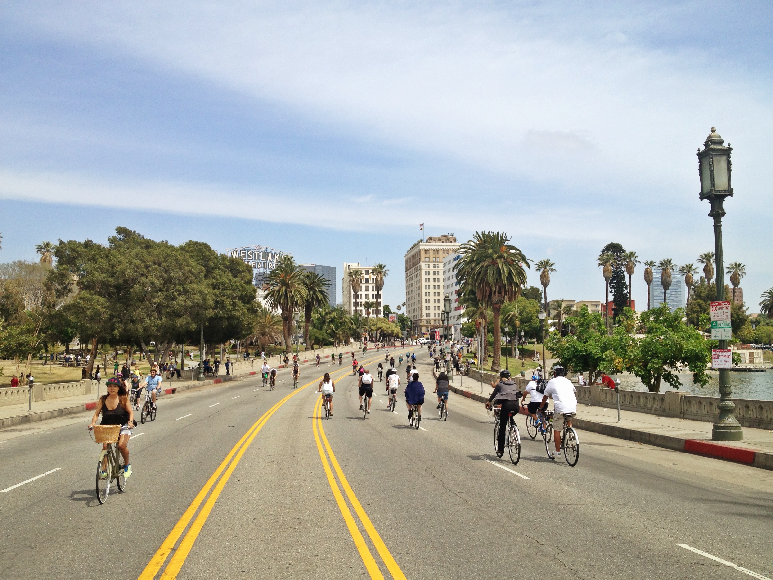
We arrived at the school around 8:10 AM during the peak of the morning parent drop-off rush. It was relatively tame on Girard: slow speeds, minor congestion and relatively fluid movement. Once we entered the adjacent neighborhood, the issues became more visible with high volumes of parent drop-off traffic observed. This created potentially dangerous situations for the many students and residents walking or biking on these streets.

We parked and entered the school grounds from one of the three walking paths which connect the neighborhood to the school. The loop road plan was briefly explained to Jeff and as we walked he began to draw.

Mr. Speck observed that there was very little traffic on Lomas considering it was the peak of morning rush hour. Sure enough, the traffic counts show that this segment of Lomas is overcapacity and does not need three lanes in each direction.

Lomas could easily lose a lane between Carlisle and Girard

For comparison in the image above, observe that Central, highlighted on the bottom of the image with a black rectangle, handles almost twice the amount of traffic (31,200 cars/day) between Girard and University with only two lanes in each direction. I encourage you to play with the large full version of the traffic count map in the image above: 2011 Traffic Flows for the Greater Albuquerque Area.

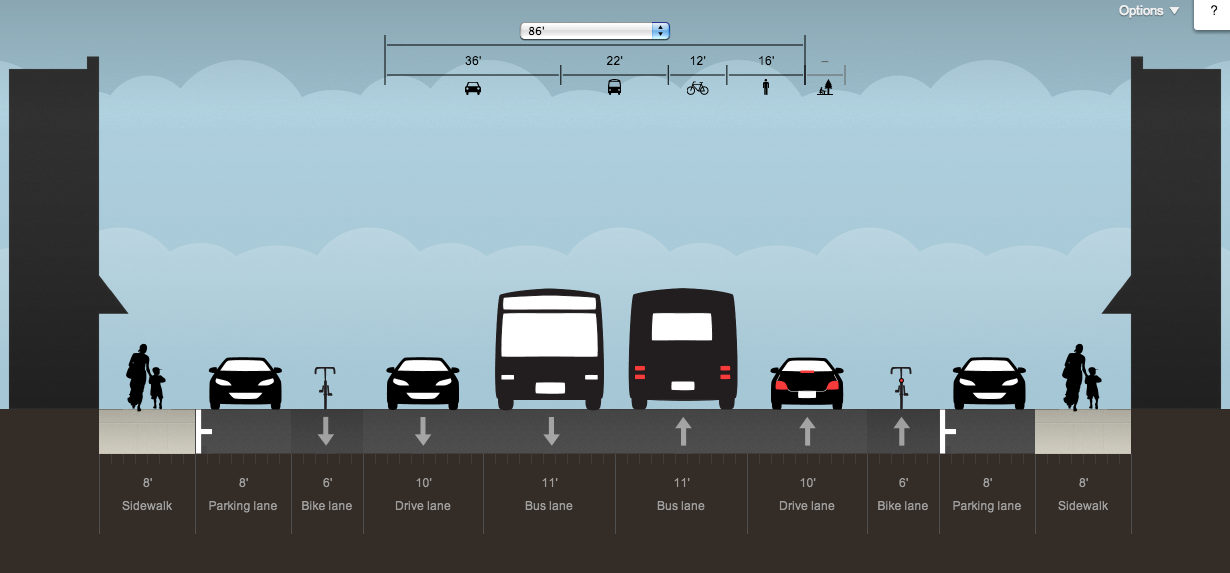
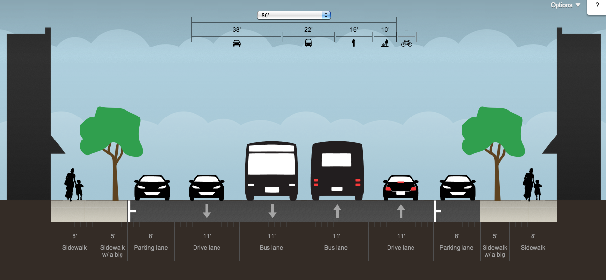
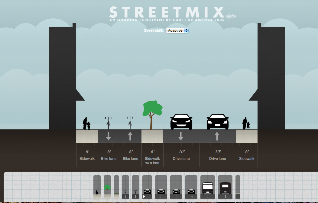
In just 45 minutes, Mr. Speck quickly sketched out three alternatives to the loop road which were far superior to anything presented by APS. They are as follows, beginning with least expensive/physically easy and ending with most expensive/physically difficult:

Click to enlarge!  This image illustrates the conversion of the existing right lane into a pick-up / drop-off lane
Click to enlarge! This image illustrates conversion of right lane into a pick-up / drop-off lane

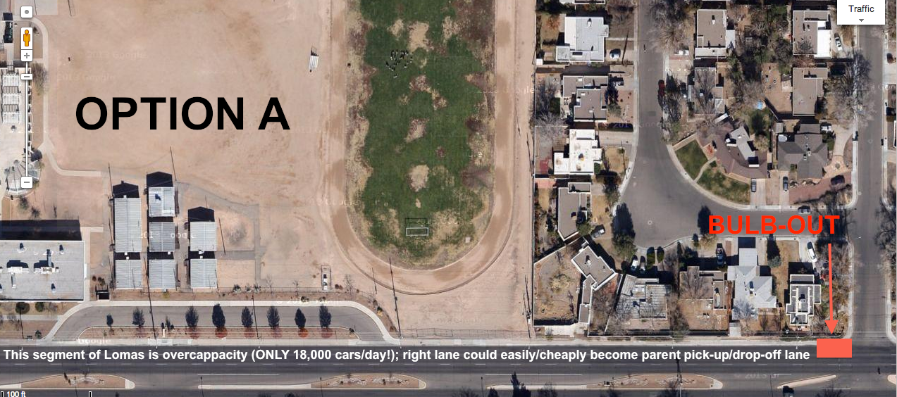
OPTION A: Blub-Out on Lomas = Traffic Calming, Lower Speeds
This plan would be both incredibly cheap and physically easy to implement. Regarding physical infrastructure, it would only require a bulb-out (COST: ~$20,000; source) and pavement markings instructing vehicles where to stack, where to turn, etc. Compare this to the cost of the proposed loop road at $572,000. The graphic above explains Option A in detail. As written in the graphic, this segment of Lomas only averages 17,400 cars/day! This volume of traffic could easily be managed with only two lanes vs. the existing three lanes.

A major side benefit of this plan would be reduced speeds and traffic calming. One less traffic lane would give vehicles one less opportunity to pass aggressively, making it safer and easier for people to cross the street.

Click to enlarge!  Speck's sketch of Options A and B
Click to enlarge! The J. Speck sketch of Options A and B
Click to enlarge!  This image shows the space available to enlarge the existing bus drop off area
Click to enlarge! This image shows the space available to enlarge the existing bus drop off area

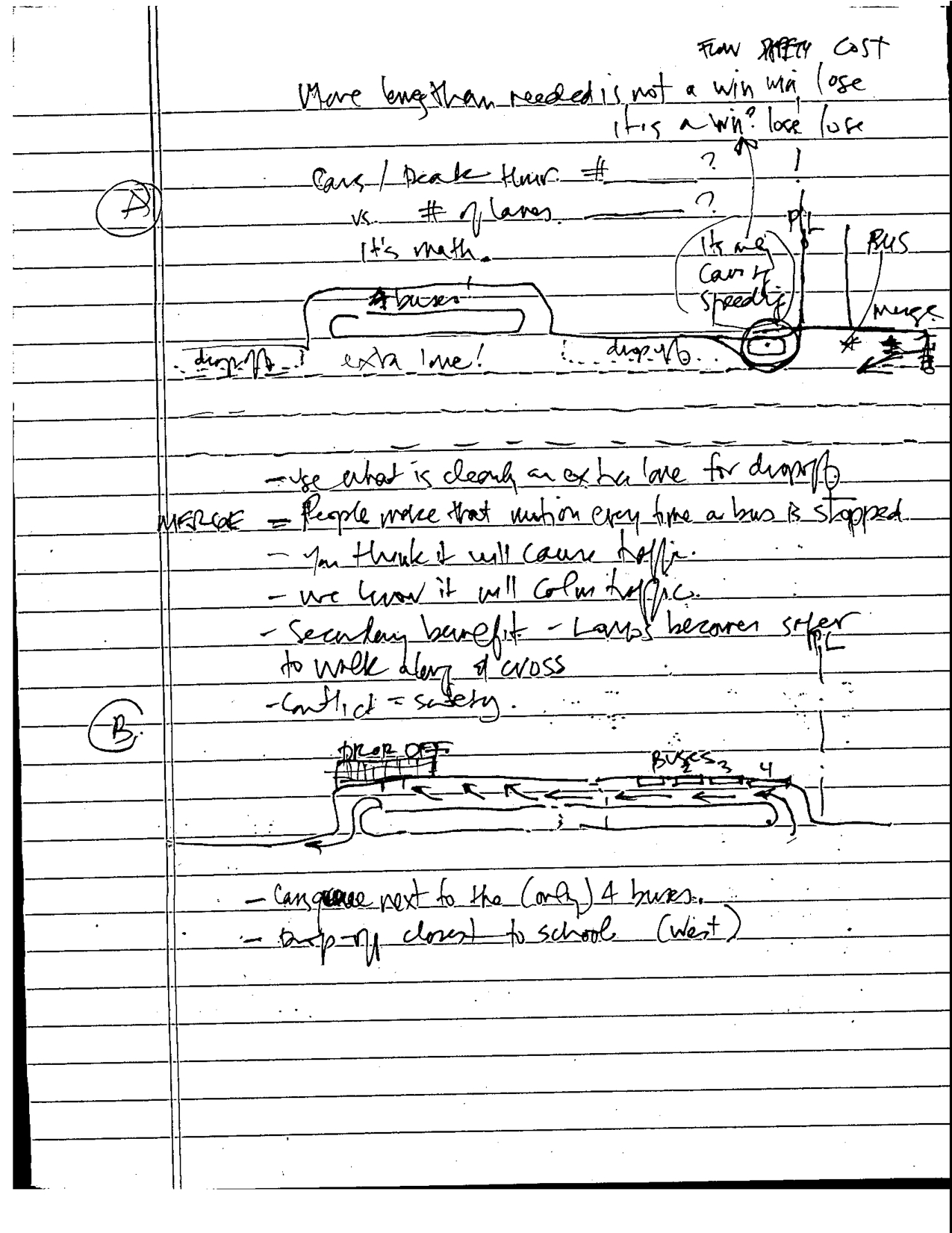
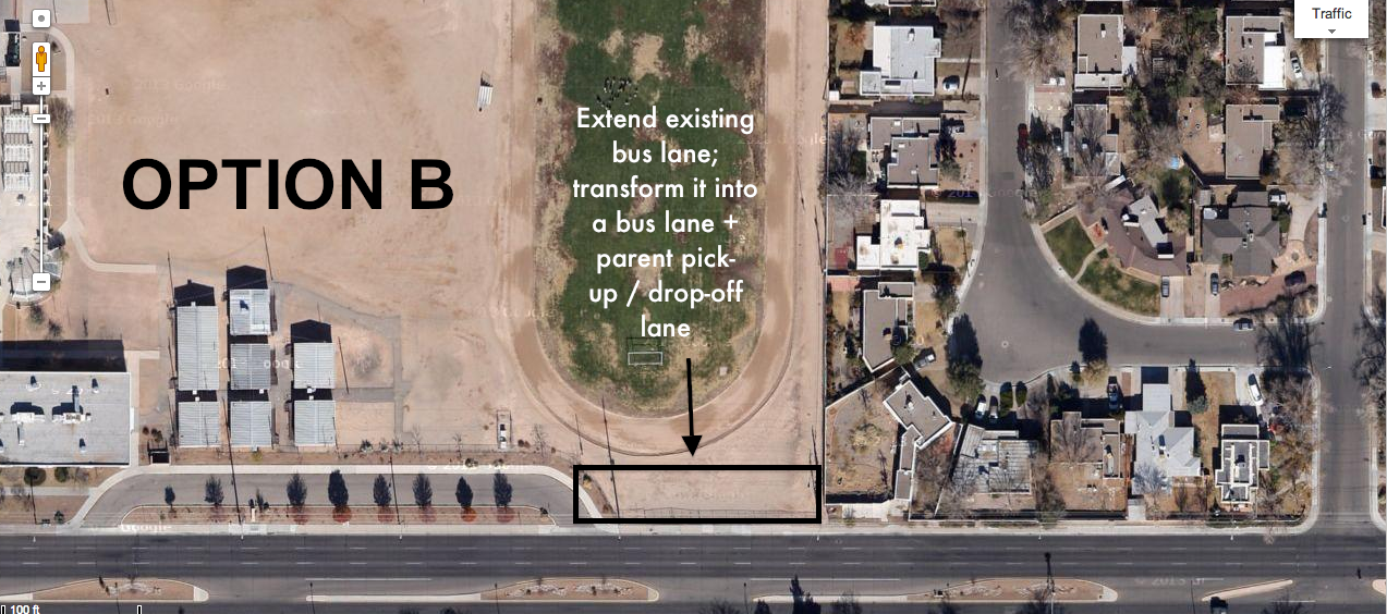
OPTION B: Extended Bus Drop-off Lane
According to neighborhood residents, Lomas is only serviced by four school buses. However, the bus lane is wide and if extended, could easily handle the existing four buses as well as a significant percentage of the parent pick-up/drop-off traffic. The graphic above explains this alternative in more detail. Since this option would involve extending something that already exists, the cost to build it would be much lower than the proposed loop road.

Click to enlarge!  In my rough illustration, the red rectangles represent the enhanced crossings proposed by Jeff Speck.  A tree lined sidewalk skirts the outer edge of the project area
Click to enlarge! In my rough illustration, the red rectangles represent the enhanced crossings proposed by Jeff Speck. A tree lined sidewalk skirts the outer edge of the project area

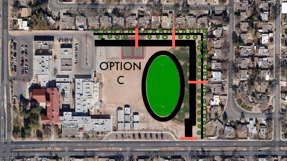
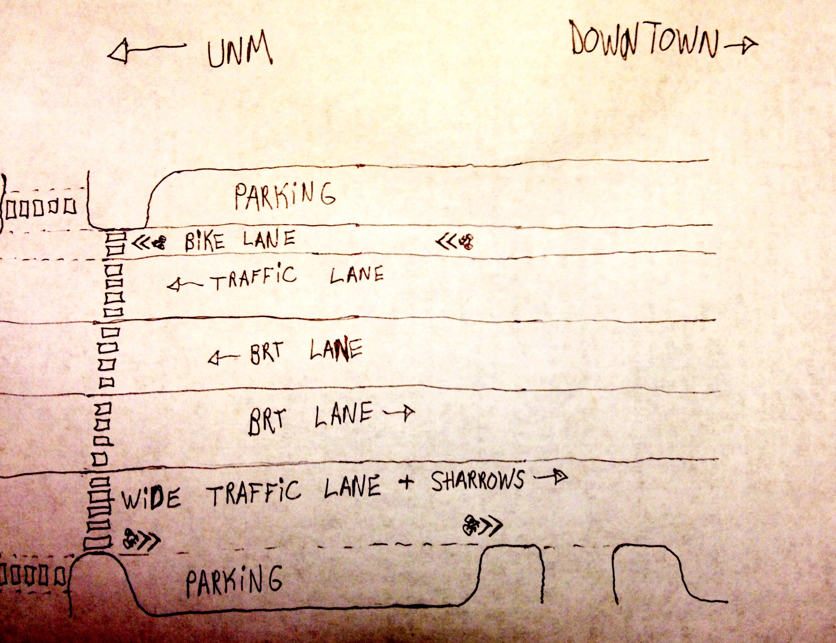
OPTION C: Tree Buffered Loop Road + Enhanced Crossings + Narrowed Pavement
This option, pictured above, would require the least amount of deviation to the existing plan. However, the enhancements discussed here would lead to a much higher quality project.

The image below was drawn by Mr. Speck. In his drawing, the proposed 24 ft. road has been transformed. Mr. Speck proposed:

12 ft driving lane +
8 ft. gravel parking lane +
6 ft. tree buffer +
6 ft. sidewalk +
6 ft. tree buffer

Click to enlarge!  The right side of this image, drawn by Speck, details proposed new alignment
Click to enlarge! The right side of this sketch by Speck details the proposed new alignment

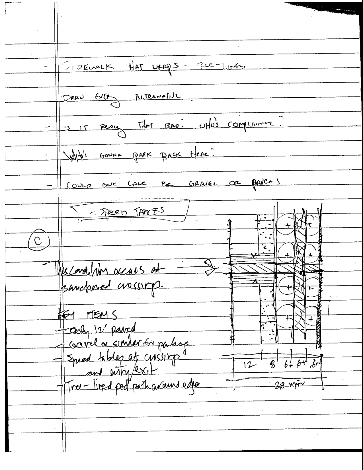
A 12 ft. driving lane plus an 8 ft. parking lane vs. the proposed 24 feet of pavement would mean lower speeds plus less storm water drainage issues.

The tree lined sidewalk would both reduce the heat island effect of the new road and provide a pleasant walking environment for the significant percentage of students who walk to school.

Another critical element of the Speck plan is raised crosswalks at all three of the neighborhood pedestrian cut throughs plus the two ends of the road. Below is an illustration of a raised crosswalk:

A hybrid crosswalk and speed table, raised crosswalks are a great way to slow down traffic and provide safe crossings

Creating Places for People
Jeff Speck saw the issues at Jefferson Middle School and quickly found cheap, easy and reasonable solutions to the current problem. Regarding Option A, Jeff Speck made this point:

If we think in isolated boxes, we are fixing a school drop off problem by creating a traffic problem. If we think synthetically, we are fixing two problems at once: school drop off and an unsafe sidewalk against speeding traffic.

This project is interesting because of the larger context. APS is one of the most influential organizations in the City of Albuquerque. If they do not have an interest in encouraging walkable environments around their schools, the whole city loses. Regarding walkability, schools and children are the lowest hanging fruit. By design, most student live in close proximity to their school, especially if it is a middle school or an elementary school. Encouraging walkability is simply good economics: parking lots and loop roads are a lot more expensive than crosswalks and bike lanes.

Jefferson Middle School has a history of students walking and biking to school. Though a significant percentage of students are now attending from outside the district, there is still plenty of opportunity to encourage walking and biking.

Since APS does not have to answer to any higher authority, they are acting in a disrespectful manner. They refuse to acknowledge all of the better options that could be used to solve the parent drop-off/pick-up problem. They want the project to be completed and for the neighbors to get out of the way.

The city has not yet granted the curb cut that Jefferson/APS needs in order to complete the road but the writing is on the wall. Within the past couple days, fences and other infrastructure have been placed, suggesting an imminent start to this project.

It is unfortunate that APS does not want to build a good relationship with its neighbors. It is a missed opportunity and it will leave behind bad blood in the neighborhood for years to come.

TAKE ACTION!
Come to the Albuquerque City Council meeting tonight (August 19) at 5 PM and speak up for progressive walkable urbanism in Albuquerque!

CicLAvia and the New Los Angeles: Lessons for ABQ from the City of Angeles

– Dan Majewski

Overlooking the 110 Freeway, Wilshire Boulevard

IMAGINE: Central Avenue, from the Rio Grande River to San Mateo, completely closed for an entire Saturday or Sunday.  Open lots filled with stages and music.  More bicycles, rollerblades, long boards and strollers than you’ve ever seen in your life.  People lying in the middle of the street on a mattress.  Tall bike riding leotard-wearing youth.  Old Route 66 transformed into New Route 66, a street for people.

Try to count the bikes!

The equivalent of this happened in Los Angeles on Sunday, June 23.  Six miles of Iconic Wilshire Boulevard, the traffic and exhaust choked historic Main Street of Los Angeles, was closed to motor vehicles from 9 AM – 4 PM.

Streets filled with people, Downtown Los Angeles

What is CicLAvia?

The concept is simple:

1)    close the street to vehicles

2)    bring in food trucks, live music, yoga teachers, etc.

3)    make sure all of the businesses along the route are open

4)    see what happens!

It is based on ciclovia, a tradition that began in Bogota, Columbia three decades ago.  The concept is now rapidly spreading across the United States and other parts of the world.  Tucson, a city with many similarities to Albuquerque, is now planning its sixth event.  An estimated 25,000 people attended the most recent event in April.  Read about my experience at the first Tucson ciclovia here.

Los Angeles first tried this experiment on 10/10/10.  The route utilized side streets that normally had little car traffic.  It had public support but many a naysayer.  After all, modern Los Angeles is practically defined by car culture.  Los Angeles is world renowned for soul-crushing traffic jams, a massive freeway system, fancy celebrity filled Ferraris, Jay Leno’s car collection… you get the idea.

Despite the doubt, the inaugural CicLAvia was a huge success100,000 people huge.

Map of the first CicLAvia event

Where is CicLAvia Now?

There will be three CicLAvia events on the streets of Los Angeles in 2013.  It has a vast array of financial supporters and local champions as shown in the photo below.

Banner displaying a portion of the major contributors to the most recent CicLAvia event

The event on June 23 was incredible.  The route itself included many famous buildings, museums and public spaces best seen at the speed of a bicycle or slower.  For the first time “dismount zones”, where people on foot were prioritized, anchored each end of the route.  It marked a welcome change in policy since the goal of CicLAvia is to open the streets to ALL non-auto users, especially people on foot.  The fact that this route was shorter than previous routes also made it easier to walk the entire distance.

Read more about the event here and here.  The official CicLAvia website can be accessed here.

Los Angeles, 2013
Los Angeles, 2013

The New Los Angeles

As someone who was born in Los Angeles and visits frequently, there is change afoot.  The Southland is truly beginning to shift its policy and funding priorities towards transit, cycling and walking.

Los Angeles, up until 5 years ago, barely had a bicycle plan.  It had little official acknowledgement of bicycles as either a form of transportation or a way to get some exercise and fresh air.  The big shift occurred when the outgoing mayor, Anotnio Villagrosa, was hit while riding his bicycle on Venice Boulevard in 2010.

Suddenly, doors opened.  It’s unfortunate that it takes a crisis but it’s incredible to see the progress since.

Los Angeles is only one of many cities in the region currently transforming its streets.  Long Beach and Santa Monica, both of which will be written about in future posts, are currently the leading the progressive urban awakening in Southern California.

Cities Are for People

The era of car dominance will be looked back upon as an odd blip in human history.  For all of time until the past 75 years, every human settlement was built around the person on foot.  Even when railroads and streetcars were invented, the city continued to retain this focus.  After all, one has to walk to the streetcar station or the railroad depot.  It is only with the advent of highly subsidized fossil fuels that our urban areas have shifted into sprawling behemoths connected by 15 lane super highways and dominated by automobile.

Los Angeles is THE poster child, the ultimate symbol for a new direction, a new future, a new hope.  With two rail transit lines under construction and three about to break ground, the people of SoCal have voted for a future where one can ride a bicycle safely on the streets of Los Angeles for more than one day a year, where you don’t need a car to get everywhere, where walking is a reasonable and safe way to move around the community.

A map of completed and under construction Metro rail lines

Central Avenue and Wilshire Boulevard: Creating a 21st Century Corridor

Central Avenue and Wilshire Boulevard are two urban corridors experiencing similar transitions.  Wilshire recently received designated bus priority lanes.  It (like Central) has more transit riders than any other corridor in the city.  Plans have been approved for rapid transit on the corridor.  However, it will be located underground, providing the city with an opportunity to reshape the streetscape dramatically.

On Central Avenue, an underground transit system makes little sense based the population of our region.  Our options at this point are to do nothing, bus rapid transit (in any variety of shapes or forms), light rail, streetcar or possibly a combination of all of the above.  Each segment of Central has a slightly different need and this needs to be acknowledged.  This community conversation is beginning to bear fruit but it is missing something: a larger regional vision.

The Need for a Regional Vision

Los Angeles is moving forward so rapidly because it developed a regional vision.  In 2008, the people of Southern California voted for a tax increase called Measure R to fund improvements in transportation around the region.  They are not the only metro area which has done this; Tucson also voted on a similar (but much smaller) proposal in 2006 called the Regional Transportation Authority.  All over the country, metropolitan areas are voting not to wait around for the federal government.  They are deciding to work together to develop a vision for the future of the region.  These movements are both bottom up and top down.

Here in Albuquerque, we recently voted to allocate local bond money to be spent on the Paseo del Norte interchange.  This project on its own is not necessarily a bad thing.  However, the fact that it was approved in isolation is a disturbing trend.  Will we continue to just vote on individual projects as needed?  This is a terrible strategy.  The PDN interchange should have been part of a larger transportation improvement package.

A rendering of the proposed improvements to PDN

The advantage of a package is projects which would not necessarily be supported independently can be funded when combined with other more popular projects.  Also, it allows everyone to get a piece of the pie.  For example, the Los Angeles funding measure allocated different percentages of the tax to different pieces of the transportation puzzle: 20% to bus operations, 20% for highway capital projects, etc.

An example from Albuquerque could be 20% for BRT, 10% for Rapid Ride, 5% for protected bike infrastructure, 30% for Paseo del Norte, etc.  The options are limitless and putting it all together results in a strategy and a vision.

ABQ 2020

In order to progress economically as region, we need to develop an infrastructure investment package.  We need to work together to find out which projects are most important, how much they will cost and how they can be a part of developing a 21st century economy.

I will be explaining the specifics of my proposal in a future post.

Thank you for reading and please comment below!

Central Avenue: The Necessity of a Strong Vision, Community Champions and Street Trees

UPDATE 2/4/16: Last night, the City of Albuquerque hosted a meeting about this BRT project on Central, now called ART. See the project website here! Many new and updated features of the project were unveiled at the meeting including pedestrian scale lighting along the entire project corridor and FREE high speed WiFi!

We will be learning if ABQ receives the federal grant for this project in less than 1 WEEK, on February 9th!

Many people believe project has been “fast tracked” without any public input. Part of why we’re reposting this article from 2013 is to disprove that point. Also, many of the concerns voiced in this article have been addressed including:

Bikes and Silver: The City has planned and begun allocating funding for improvements to Silver. This does not mean that Silver will extend past the freeway. However, the city is also going to be making major improvements to bike facilities on MLK, already a heavily used bicycle corridor that connects UNM to Downtown. We still believe that there are unanswered questions about bikes on Central but overall, many improvements to the plan have been made.

Medians vs. Wider Sidewalks: The folks in Nob Hill came to an agreement with the project planners and there will be wider sidewalks through Nob Hill instead of medians, a huge improvement for the business district. In fact, sidewalks will be widened and improved throughout much of the corridor and pedestrian scale lighting will be added throughout the entire corridor!

Marketing, Outreach and Champions: This project has found a champion in the form of Mayor Berry.

However, outreach and marketing by the City on behalf of this project has been too little, too late. Unfortunately, outside sources have spread misinformation about the project. Independent from those outside sources, there has been resistance to the project for a variety of reasons. In addition, it is not always easy to communicate the benefits of this project, the construction process, the potential impacts and other aspects of this proposal.

The people running this project, as of very recently, finally starting using a Facebook page to communicate information. The City needs to do better promotion and outreach for these types of projects to get ahead of any possible pushback or misinformation campaigns. It’s not an easy thing to do but it can be done.

There’s plenty more to be said about this project and we will continue discussing it on our Facebook page.

The original article, in it’s unaltered form, is below:

“Central Avenue: The Necessity of a Strong Vision, Community Champions and Street Trees”

-Dan Majewski, May 2013

BRT meeting, ABQ Museum

During the month of May in 2013, the City of Albuquerque held six public meetings about a proposed Bus Rapid Transit (BRT) system for Central Avenue. Every meeting was held in a different location and focused on a different segment of the proposed project.

The format of the meeting was as follows:

  • 15 minute power point presentation about BRT + benefits of the project + why it should be built
  • 30 minute collaborative work session: we broke into small groups and conversed with consultants about what we like on the corridor, what we don’t like, what type of project alignment we would like to see, etc.
  • 15 closing presentations by each of the small groups

The collaborative element was useful. It allowed us to effectively express our opinons and hash out a vision for the corridor. It was also an opportunity to air grievances without having to interrupt the larger group presentation.

Bus Rapid What?

BRT Rendering

I attended two of these meeting and came away with mixed feelings.  BRT could be a great solution to the current transportation problems currently found on Central Avenue but it must be marketed correctly and executed properly.  Scroll to the bottom of the article for my full reaction.

Sorry, No Bicycles Allowed

For rapid transit systems to work, they must attract people from a wide geographic area.  To accomplish this, bicycles can be a great tool.  When asked about bicycles at this meeting, many of the consultants or city leaders implied that bicycles do not belong on Central Avenue.  “Why not the Silver Bicycle Boulevard?  Or MLK?  Or Lead/Coal?” they would say.  My response:

  1. Silver is great… until it dead ends at I-25.  It does not connect the University of New Mexico to Downtown, Old Town or the Bosque Trail.

    As you can see, the Silver Avenue Bicycle Boulevard ends at the interstate.
    The blue line on this map is the Silver Avenue Bicycle Boulevard. As you can see, it currently ends at the interstate freeway on the left side of this image.
  2. Most of the desired destinations are located on Central.  I may use Silver for 90% of my trip.  However, since my end destination is located on Central, I need to bike on Central for at least a block or two.  This means riding on the sidewalk (dangerous/illegal) or in the street (terrifying).
  3. Whether you like it or not, there is already a lot of bicycle traffic on Central.  It will only increase over time as this corridor becomes more dense.
  4. Accommodating bicycles does not necessarily mean 6 foot bike lanes in each direction.  It simply means providing infrastructure where possible.  This is an example of what bicycle accommodation could look like in the narrow segment between University Boulevard and I-25:

central

The Nob Hill No

The Nob Hill Neighborhood is the most organized and wealthy stakeholder group on this corridor.  They are also the most frustrated and angry about this proposal.  From their perspective, CABQ is trying to take away something (the medians) which presently provide safe pedestrian refuge.

True BRT = one general traffic lane in each direction.  This would lead to slower traffic speeds, creating a safer pedestrian environment and reducing the need for median pedestrian refugees.  However, the city has not adequately demonstrated the exchange of the medians for a world class rapid transit system.  The project leaders have not clarified how many crossings for people on foot would exist along the segment.  Also, it appears to Nob Hillers that this system will simply be going through the neighborhood without stopping (as the current alignment exists).  CABQ and ABQ Ride are not effectively selling the system to the neighborhood.

The city should explain that instead of the medians, Nob Hill could get wider sidewalks or bicycle lanes.

Using Streetmix, here’s how the Nob Hill segment currently looks:

Streetmix: nob hill current

Here’s how this segment could look with bicycle lanes:

Nob Hill, bike lane option

It could also look like this, replacing bicycle lanes with wider sidewalks:

Nob Hill; BRT + street trees

There are many potential positive possibilities.

Lessons from Ft. Collins, CO

On February 21st, the ULI (Urban Land Institute) hosted a full day conference about BRT in Albuquerque called Transit and Place: First Steps.  The day was filled with fantastic presentations from transit providers and developers nationwide.

Kurt Ravenschlag from Ft. Collins, CO delivered a wonderful presentation about the Mason Street Corridor BRT Project.  Initially, the project did not go over well in this mid sized college town.   It was rejected by the business community because the city was not emphasizing the economic benefits of the project, such as increased values around the station areas.   The transit provider was forced to go back to the drawing board.  The re-marketing of the proposal was successful and the project is now being constructed with major local support.

The City of Ft. Collins did not change the project!  They only changed the sales pitch.

All Together Now

The City of Albuquerque is currently working on a Complete Streets Plan for Central Avenue between 1st St. and Girard.  Isolated from the BRT project, this plan has its own webpage, a separate set of public meetings and different group of consultants.

This needs to change.

The BRT plan and the Complete Streets plan are the same thing!  They both have the same vision: increased economic development and a safer more beautiful street for people moving throughout the corridor.  Why are there two separate plans?

Mr. Ravenschlag from Ft. Collins emphasized the importance of first laying out a vision for the corridor.  Streetscaping should be the first conversation, followed by zoning overlays and bicycle/pedestrian access.  After all of that, transit should be discussed.

Reframing the Conversation

Central Avenue is in desperate need of a solution.

Half of all transit trips in the city are on this corridor.

It is Albuquerque’s main street but it is marked by vacant lots, visible poverty, fast moving automobile traffic, high pedestrian fatality rates, unsafe intersections and a lack of cohesiveness.

Rapid transit will be a part of the solution but it can not come at the expense of all the other elements.  Wide shaded sidewalks, bicycle infrastructure, rezoning of the corridor, reduction of parking minimums and safe pedestrian crossings at every intersection are all more important to the long term success of Central Avenue.

This project needs a stronger emphasis on the complete streets and economic development elements of the project.

ABQ Ride and the City of Albuquerque need to go back to the drawing board and figure out how to sell BRT as a larger part of the revitalization of the Central Avenue corridor.

The sales pitch could be something like this:

IMAGINE… an improved Central Avenue, Albuquerque’s Main Street.  Envision wide, smooth, safe sidewalks shaded with large native street trees.  Think of slow moving vehicle traffic and narrow, easy to cross intersections.  Visualize vacant lots disappearing, then filled with shops next to the sidewalk and apartments above.  Feel the warm summer air as you leave your apartment and walk a few steps away to a rapid transit station.  The station has shade, real time arrival information and other amenities.  However, you barely have time to look at all of it since a transit vehicle arrives every five minutes.  The successful vibrant Albuquerque of the future is linked to this critical corridor.

Can you see it?  I sure can.  For it to manifest, it will take strong local champions and a chorus of voices demanding a safer, more prosperous and more beautiful Albuquerque, a city for PEOPLE, where motor vehicles are guests.

It’s a difficult challenge but it’s our best hope for long term economic vitality.

Get involved!

Please comment below if you have questions or comments about this post.

For more information on the Central Avenue BRT project, click this link.

For more information on the Central Avenue Complete Street Plan, click this link.

Like the Complete Streets in New Mexico Facebook page for more news and information.

Like UrbanABQ on Facebook for more news and information.

Parklets Hit the Primetime

this one!
Channel Four News aired a segment last night about parklets. Tim Trujillo gracefully covered the subject in the video segment, explaining the social and economic benefits of having safe and pleasant places to hang out and spend time Downtown. Here’s a link to the full article and video.

In cities where parklets have already been built (such as NYC and San Francisco) local businesses were not initially supportive. Once businesses realized people spent more money in places where they could safely sit, demand for parklets and plazas increased. For example, in Times Square NYC, a large portion of Broadway Blvd. was converted into a plaza in 2009. Since that change occurred, retail sales and rent values have skyrocketed (Streetsblog NYC). All over America and the world, residents and planners are realizing that people are the key to successful places and spaces; cars are secondary. Soon, Albuquerque will join a group of great American cities that prioritizes space effectively and reallocates space from cars to people without much more than a signed piece of paper. Until that moment, we must all join together and tell our city what we want.

Albuquerque is NOT for cars; it is for us, people, Burqueños. We want to walk and bike and use all of the streets safely. Our city leaders understand this but they need to hear the message more forcefully. Other cities across the country are beginning to realize that endless low density sprawl is a recipe for economic disaster. A strong core is key to the success of a metro area and parklets are a step in the right direction.

-Dan

Design Your Own Street – Central Ave.

This is an example of a streetscape created with Streetmix
Example of a streetscape created with Streetmix

Our post yesterday set the stage well for this post, which will allow the reader to choose street space priorities on his or her own.

Though this was posted a couple of months ago on Atlantic Cities, this neat application is especially relevant as the Central Ave. complete street plan moves forward.

The Central Ave. redesign process (or any street redesign process) is contentious as there is limited right of way, or ROW. Up until the project breaks ground and even after, people will debate the best and highest use of the limited ROW available, especially between I-25 and University. It may seem obvious to us what the best use of the space is but it’s helpful to see what other citizens think about the matter.

Streetmix allows the planner, citizen and any other interested party to truly feel out the options. It allows one to see how many feet of ROW each mode uses.

Here is the approximate available ROW on Central Ave. where this redesign process will be happening.

Between Broadway and I-25 (EDo) –> 83 ft.
Between I-25 and University –> 96 ft.
Between University and Girard –> 115 ft.

The challenge: how much can you squeeze in? BRT (bus rapid transit) lanes? Bike lanes? On street parking?

Happy planning!

-Dan